Search

Search Results

A new and accurate map of the East India Islands: laid down according to the latest discoveries, and agreeable to the most approved maps & charts

event1750

location_onBrunei, Cambodia, East Timor, Indonesia, Laos, Malaysia, Myanmar, Vietnam, Thailand, Southeast Asia, Singapore, Philippines

This mid-18th century map of Southeast Asia includes written notes on goods produced and traded, geographical features, and wild animals found in each part of the region. The cartouche features a drawing of Asia with people, fields and palm trees.

A new and accurate map of the East India Islands: laid down according to the latest discoveries, and agreeable to the most approved maps & charts

eventc.1744-1747

location_onBrunei, Cambodia, East Timor, Indonesia, Laos, Malaysia, Myanmar, Philippines, Singapore, Southeast Asia, Thailand, Vietnam

This mid-18th century map of Southeast Asia includes written notes on goods produced and traded, geographical features, and wild animals found in each part of the region.

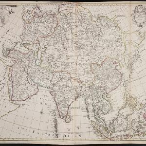
Asia: corrected from the observations communicated to the Royal Society at London and the Royal Academy at Paris

event1725

location_onBrunei, Cambodia, East Timor, Indonesia, Laos, Malaysia, Myanmar, Philippines, Singapore, Southeast Asia, Thailand, Vietnam

An early 18th century map of Asia by the English cartographer John Senex, featuring labels noting details of the inhabitants of some areas e.g. on Borneo: ‘The Middle of this Isle is Inhabited by a People call’d Beaujous Idolaters’.

Asia corrected from the observation communicated to the Royal Society at London and the Royal Academy at Paris

eventc.1714

location_onBrunei, Cambodia, East Timor, Indonesia, Laos, Malaysia, Myanmar, Philippines, Singapore, Southeast Asia, Thailand, Vietnam

This early 18th century map of Asia features a drawing of a woman burning offerings on an altar, while two children carry cornucopias, and a camel looks on. The Roman god Mercury descends from the sky in the background wearing his winged helmet.

Asia corrected from the observation communicated to the Royal Society at London and the Royal Academy at Paris

event1713

location_onBrunei, Cambodia, East Timor, Indonesia, Laos, Malaysia, Myanmar, Philippines, Singapore, Southeast Asia, Thailand, Vietnam

This early 18th century map of Asia features a drawing of a woman burning offerings on an altar, while two children carry cornucopias, and a camel looks on. The Roman god Mercury descends from the sky in the background wearing his winged helmet.

Asia: corrected from the observations communicated to the Royal Society at London and the Royal Academy at Paris

event1708

location_onBrunei, Cambodia, East Timor, Indonesia, Laos, Malaysia, Myanmar, Philippines, Singapore, Southeast Asia, Thailand, Vietnam

An early 18th century map of Asia by the English cartographer John Senex, featuring labels noting details of the inhabitants of some areas e.g. on Borneo: ‘The Middle of this Isle is Inhabited by a People call’d Beaujous Idolaters’.

close