Search

Search Results

Asia cum omnibus Imperiis, Provinciis, Statibus et Insulis correcta et adornata

event1840

location_onBrunei, Cambodia, East Timor, Indonesia, Laos, Malaysia, Myanmar, Papua New Guinea, Philippines, Singapore, Southeast Asia, Thailand, Vietnam

This colourful map of Asia has an elaborate cartouche featuring two Asian men talking—one carries a bow, the other smokes a long pipe—while a lion sits nearby. The scale is also illustrated, with drawings of Asian birds.

Bowles's new one-sheet map of Asia, divided into its empires, kingdoms, states, and other subdivisions

event1795

location_onBrunei, Cambodia, East Timor, Indonesia, Laos, Malaysia, Myanmar, Papua New Guinea, Philippines, Singapore, Southeast Asia, Thailand, Vietnam

A late 18th century map of Asia published in London by John Bowles, with regions indicated by colour. Central Borneo is labelled ‘Part inhabited by the Biayos’, which is seen on many contemporary maps, often with the comment ‘a savage people’.

Nieuwe en naukeurige kaart van Asia

event1773

location_onIndonesia, Brunei, Cambodia, East Timor, Laos, Malaysia, Myanmar, Papua New Guinea, Philippines, Singapore, Southeast Asia, Thailand, Vietnam

Map of Asia featuring an early—and very vague—depiction of New Britain (‘Nieuw Brittanje’) which was named by the British explorer William Dampier when he visited in 1700. The ‘Straat van Dampier’ is also shown, dividing New Britain from New Guinea.

Carte Réduite des Terres Australes = Gereduceerde Kaart van 't Zuid-Land

event1758

location_onIndonesia, Papua New Guinea

New Guinea is shown connected to Australia (‘Nouvelle Hollande’) on this mid-18th century map. The title’s ‘Terres Australes’ means ‘southern lands’ indicating how Australia was named. The text is in French, with the title also in Dutch at the base.

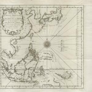
Suite de l'Ocean Oriental contenant les Isles de la Sonde, les costes de Tunquin et de la Chine, les isles du Japon, les Philippines, Moluques

event1746

location_onBrunei, Cambodia, East Timor, Indonesia, Malaysia, Papua New Guinea, Philippines, Singapore, Southeast Asia, Thailand, Vietnam

The coast of New Guinea (‘Nova Guinéa’) is represented in part by a dotted line on this mid-18th century map, indicating that the exact coastlines were unknown at this time. Originally in French, the map has been modified to add Dutch text as well.

Suite de l'Ocean Oriental contenant les Isles de la Sonde, les costes de Tunquin et de la Chine, les isles du Japon, les Philippines, Moluques

event1746

location_onBrunei, Cambodia, East Timor, Indonesia, Malaysia, Papua New Guinea, Philippines, Singapore, Thailand, Vietnam, Southeast Asia

The coast of New Guinea (‘Nouvelle Guinée’) is represented in part by a dotted line on this mid-18th century map, indicating that the exact coastlines were unknown at this time. The western tip is labelled ‘C. de Bonne Esperance [Cape of Good Hope]’.

Recentissima Asiae Delineatio: Qua Imperia eius, Regn, et Status...

event1730

location_onBrunei, Cambodia, East Timor, Indonesia, Laos, Malaysia, Myanmar, Papua New Guinea, Singapore, Philippines, Southeast Asia, Thailand, Vietnam

This map's cartouche features an illustration of three men bowing before a ruler on a throne. There is also what was probably meant to be a lion, though the poor likeness suggests it was based on written descriptions rather than real life experience.

close