Search

Search Results

A new chart of the eastern straits to China drawn from the best authorities

event1800

location_onIndonesia

Two maps of routes around the Flores and Banda seas—through the straits between the Lesser Sunda Islands and the Maluku Islands—towards China. Includes a rhumbline network—a web of lines to help plot routes—bathymetry (sea depth), shoals and reefs.

Laphao

event1780

location_onEast Timor, Indonesia

A page from Abbé Prévost’s ‘Histoire Générale des Voyages’. The top map shows the Bay of Laphao on Timor, while the other drawings are side views (or ‘elevations’) of mountains on the region’s islands to use as landmarks when navigating.

De landvoogdy van Amboina met de elf onderhoorige eylanden

event1726

location_onIndonesia

Although mainly a navigation map—with a rhumbline network and elevations of mountains—there are also many terrestrial details shown, such as settlements and mountains. The inset map of Hoeamohel details plantations and the cultivation of nut crops.

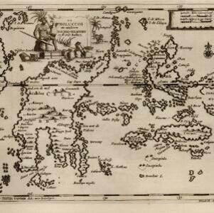
De Moluccos en andere Speceri-Eilanden in d'Oost-Indien

event1714

location_onIndonesia

Map of the ‘Spice Islands’ of maritime Southeast Asia, including the Maluku Islands. It is decorated with a drawing of an Asian man holding a large bird and a spear, and surrounded by baskets and boxes of goods of the spice trade.

Insulæ Indiæ orientalis præcipuæ: in quibus Moluccæ celeberrimæ sunt

event1623

location_onBrunei, Cambodia, East Timor, Indonesia, Laos, Malaysia, Myanmar, Philippines, Singapore, Southeast Asia, Thailand, Vietnam

On the right of this map, Latin text held within an elaborate border notes that five of the Maluku Islands are located nearby—Ternate, Tidore, Moti, Makian and Bacan—which trade spices including clove, cinnamon, nutmeg and ginger to the world.

Description de la coste septentrionale de Noua Guinea

event1618

location_onIndonesia

The north coast of New Guinea is mapped here as it was discovered by the Dutch explorer Willem Corneliszoon Schouten. He is named on the map as Guillaume Schouten de Hoorn, known as the first to sail from Europe to the Pacific Ocean via Cape Horn.

Insulæ Indiæ orientalis præcipuæ: in quibus Moluccæ celeberrimæ sunt

event1606

location_onBrunei, Cambodia, East Timor, Indonesia, Laos, Malaysia, Myanmar, Philippines, Singapore, Southeast Asia, Thailand, Vietnam

On the right of this map, Latin text held within an elaborate border notes that five of the Maluku Islands are located nearby—Ternate, Tidore, Moti, Makian and Bacan—which trade spices including clove, cinnamon, nutmeg and ginger to the world.

close