Search

Search Results

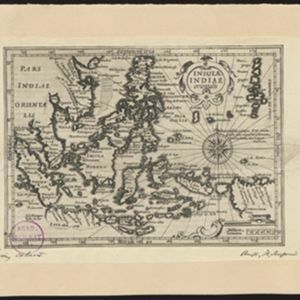
Insularum Indiæ orientalis nova descriptio

eventc.1700

location_onBrunei, Cambodia, East Timor, Indonesia, Laos, Malaysia, Myanmar, Philippines, Singapore, Southeast Asia, Thailand, Vietnam

The outline of the island of New Guinea is very vague on this early 17th century map of Southeast Asia. The cartouche is decorated with two figures of Asian warriors: one holds a spear, the other a sword. There are also drawings of mermaids.
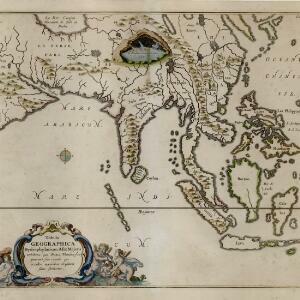
Tabula Geographica Hydrophylacium Asiae Majoris exhibens, quo Omnia Flumina sive proximè sive remotè per occultos meandros Originem suam sortiuntur

event1665

location_onBrunei, Cambodia, Indonesia, Laos, Malaysia, Myanmar, Philippines, Singapore, Southeast Asia, Thailand, Vietnam

This map by Athanasius Kircher shows the ‘hydrophylacium’ of Asia, a mythical subterranean ocean that Kircher thought fed rivers and caused tides. Illustrations of Neptune, the god of the sea, and cherubs playing in water continue the aquatic theme.

Mar di India

event1644

location_onBrunei, Cambodia, East Timor, Indonesia, Laos, Malaysia, Myanmar, Philippines, Singapore, Southeast Asia, Thailand, Vietnam

This mid-17th century map of Southeast Asia is from Isaac Commelin’s book describing the voyages of the Dutch East India Company ‘Begin ende voortgangh…’. There is an inset map of the island of Botton (Buton Island, southeast of Celebes (Sulawesi)).

Insulae Indiae orientalis

event1634

location_onBrunei, Cambodia, East Timor, Indonesia, Laos, Malaysia, Myanmar, Philippines, Singapore, Southeast Asia, Thailand, Vietnam

On this early 17th century map of maritime Southeast Asia, the southern coast of Java ('Iava Maior') is represented by a dotted line, indicating that the exact coastline was unknown at this time.

Mar di India

event1619

location_onBrunei, Cambodia, East Timor, Indonesia, Laos, Malaysia, Myanmar, Philippines, Singapore, Southeast Asia, Thailand, Vietnam

An early map of Southeast Asia featuring a rhumbline network, a web of lines to help plot routes and aid navigation. Where the lines meet, there is a compass rose with an arrow pointing north. The map is decorated with illustrations of sea monsters.

close

  • Filter from 1619 to 1700

Current results range from 1619 to 1700