Search Results

S.E. Peninsula and Malaysia
1849
Brunei, Cambodia, East Timor, Indonesia, Laos, Malaysia, Myanmar, Papua New Guinea, Philippines, Singapore, Southeast Asia, Thailand, Vietnam
The colonial possessions of Britain, the Netherlands, Spain, Portugal and Denmark are shown on this mid-19th century map of Southeast Asia. There are inset maps of Penang Island and Singapore, and text describing the region’s colonial history.

General-Karte von Mittleren Sumatra von Padang bis Singkel
1847
Indonesia
This map focuses on the mountain ranges along the west coast of central Sumatra. Military bases, post offices, villages, rivers and hot springs are also marked, and there are inset maps of the towns of Padang and Singkel (Singkil).

Algemeene kaart van Nederlandsch Oostindie
c.1839-1855
East Timor, Indonesia, Malaysia, Singapore
This map of the Dutch East Indies is spread over eight sheets, with a hand-drawn cover sheet showing the whole area. There are numerous inset maps of islands, bays, cities etc. Two of the inset maps have a replacement map pasted over them.

Map of the Eastern Frontier of British India, with the adjacent countries
1838
Myanmar, Thailand
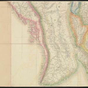
Regional and local borders are colour-coded, with mountains and rivers, settlements, paths/roads and names of local peoples marked. Notes such as ‘Gold dust found in these streams’ and ‘Rich in Tin’ add detail. Only two of four sheets are available.

A map of Java: chiefly from surveys made during the British administration
1817
Indonesia
Made for ‘A History of Java’ by Sir Stamford Raffles, this map includes a list of administrative districts with their populations, and four inset maps of harbours. Another inset map shows rocks and minerals, mountains and volcanoes, and teak forests.
- Filter from 1775 to 1899
- [remove]Kampong/Village242
- Residential Area70
- Post Office61
- Cemetery/Columbarium50
- Military Fort50
- Hospital29
- Military Barracks27
- Church23
- Mosque22
- Temple22
- Jail/Prison19
- Police Station14
- Public Space12
- Palace11
- more Settlement Features »
- [remove]Contour Lines/Elevation242
- Scale219
- Longitude and Latitude192
- Written Note/Details60
- Compass Rose28
- Rhumbline Network2


