Search Results

Sumatra: Residentie Benkoelen (Bengkoelen)
c.1894-1895
Indonesia
Map of the residency of Benkoelen (Bengkulu, southwest coast of Sumatra), over 10 sheets, with an inset map of the city of Bengkoelen (Bengkulu). Types of crops—coconut, rice, alang-alang, nipah palm, coffee—are marked. Sheet number 8 is missing.

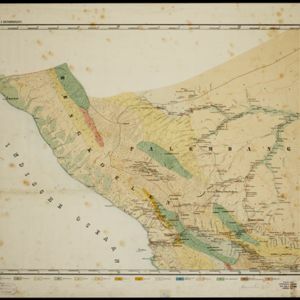
Topographische en geologische kaart van Zuid-Sumatra bevattende de residentien Bengkoelen, Palembang en Lampongsche Districten
1880
Indonesia
A topographical and geological map of southern Sumatra, over four sheets. Areas of igneous and sedimentary rock, coal, fossils, petroleum, active volcanoes and hot springs are marked, along with mountains, rivers and marshland, roads and settlements.

Kaart van een gedeelte van midden Sumatra
1876
Indonesia
This map of central Sumatra is dominated by the rivers that flow east, from the west coast mountain ranges to the Malacca Strait (labelled ‘Zee van Riouw’). The largest is the Batang Hari River that flows through the city of Djambi (modern Jambi).


