Search

Search Results

Nederland en deszelfs koloniën

event1844

location_onBrunei, East Timor, Indonesia, Malaysia, Singapore

Map of the East Indies, with the borders of Dutch colonial territory marked in brown. The Malay Peninsula (‘Malakka’) has green borders, indicating it is a British possession. Four inset maps show other Dutch territories outside Southeast Asia.
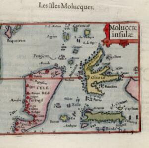
Moluccæ insulæ

event1602

location_onIndonesia

This early 17th century map features Gilolo (Halmahera) and Seram, as well as Celebes (Sulawesi). French text on the reverse describes the ‘Isles Molucques’ (Maluku Islands), including trade in nutmeg, mace, aloe, cinnamon, ginger, pepper and cloves.

close

  • Filter from 1602 to 1844

Current results range from 1602 to 1844