
Search Results
Filter
Map Attributes
Longitude and Latitude
Remove constraint Map Attributes: Longitude and Latitude
Detailed Location
Halmahera Sea
Remove constraint Detailed Location: Halmahera Sea
Political Regions
District/Administrative Border
Remove constraint Political Regions: District/Administrative Border
3 Results found

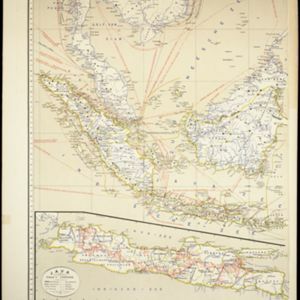
Kaart van Nederlandsch-Indie
1893
Brunei, Cambodia, Indonesia, Malaysia, Singapore, Thailand, Vietnam, East Timor, Philippines, Southeast Asia
Shipping routes are the focus of this map of the Dutch East Indies, indicated by red lines labelled with the name of the shipping company and the destinations. Parcel shipping routes are also shown. Inset maps feature railway lines too.

Kaart van Ternate, Halmaheira en Omringende Eilanden
1854
Indonesia
Map of Halmahera and other of the northern Maluku islands, colour-coded by their administrative region, with the seas and passages between them named. (From ‘Algemeene Atlas van Nederlandsche Indie [General Atlas of the Dutch East Indies]’.)
- Filter from 1854 to 1898
- [remove]District/Administrative Border3
- Civic/Metropolitan Border1
- Colonial Possessions1


