
Search Results
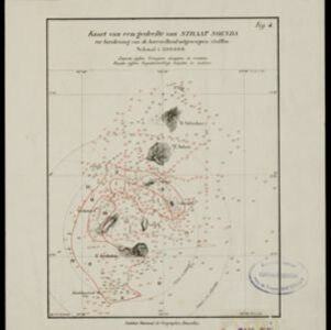

Kaart van het westelijk gedeelte van den Indischen Archipel
1883
Indonesia, Malaysia, Singapore
The shaded area on this map is where volcanic ash fell from the 1883 eruption of Krakatoa (Sunda Strait between Sumatra and Java). Red figures record the thickness of the ash in millimetres; black figures are distance from the eruption in kilometres.

Wereldkaart volgens Mercator's projectie
1883
Brunei, Cambodia, East Timor, Indonesia, Laos, Malaysia, Myanmar, Papua New Guinea, Philippines, Singapore, Southeast Asia, Thailand, Vietnam
A map charting the effects of the 1883 Krakatoa volcanic eruption: a red circle where the eruption was heard; black lines showing the hourly spread of the resulting waves; and a list of ships on which ash fell, or that encountered pumice (with date).


A new chart shewing the navigation through the Strait of Sunda to Batavia
1815
Indonesia
Navigation chart of the Sunda Strait, with sea depth, anchor points, shoals and other obstructions. Includes many bays, with four highlighted on inset maps. Partly based on writings of Captain Krusenstern whose 1806 route through the strait is shown.

Carte du Détroit de la Sonde, depuis la pointe de Winerou jusques à l'Isle du Nord
c.1790
Indonesia
Navigation chart of the Sunda Strait, focusing on bays and islands, and showing bathymetry (sea depth), anchor points, shoals and reefs. Includes an inset map of the bay of the Isle de Mew (Peucang Island). The web of lines is a rhumbline network.
- Filter from 1790 to 1883
- [remove]Longitude and Latitude9
- Scale8
- Compass Rose5
- Contour Lines/Elevation4
- Rhumbline Network4
- Written Note/Details2


