Search

Search Results

Kaart van 't noordwestelijke gedeelte der Residentie Ambon

event1898

location_onIndonesia

Map of the residency of Ambon in the Maluku Islands, divided by colour-coded administrative borders. There are inset maps the Banda Islands—including the nutmeg plantations and the town of Neira with its fort and hospital—and of Dutch New Guinea.

Kaart der Molukken

event1898

location_onIndonesia, East Timor

Map of the Moluccas (Maluku Islands) divided into the residencies of Ternate (orange borders) and Ambon (green borders). Many place names are in Dutch and Malay, and there is an inset map of the city of Ambon. Timor is marked as Portuguese territory.

Kaart der Nederlandsche Bezittingen of het Eiland Nieuw-Guinea

event1853

location_onIndonesia

Map of Dutch colonial territory in New Guinea and nearby islands, featuring the 1850 route of the Dutch schooner Circe under Lieutenant Brutel de la Rivière. (From ‘Algemeene Atlas van Nederlandsche Indie [General Atlas of the Dutch East Indies]’.)

A new chart of the eastern straits to China drawn from the best authorities

event1800

location_onIndonesia

Two maps of routes around the Flores and Banda seas—through the straits between the Lesser Sunda Islands and the Maluku Islands—towards China. Includes a rhumbline network—a web of lines to help plot routes—bathymetry (sea depth), shoals and reefs.

[Dutch portolan chart of the eastern Dutch East Indies]

event1700

location_onIndonesia, East Timor

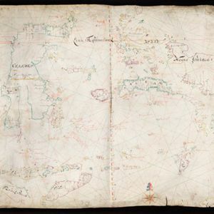
This colourful hand-drawn portolan (nautical) chart was designed to aid navigation. It features a rhumbline network (the web of interconnected lines), bathymetry (sea depth), shoals and reefs, anchor points and written notes.

Insulæ Indiæ orientalis

event1690

location_onBrunei, Cambodia, East Timor, Indonesia, Laos, Malaysia, Myanmar, Philippines, Singapore, Southeast Asia, Thailand, Vietnam

The southern coast of Java ('Iava Maior') on this map is represented by a dotted line, indicating that the exact coastline was unknown at this time. Italian text on the reverse describes the Maluku Islands including Ambon, Banda and Ternate.

Asiae nova descriptio

event1653

location_onBrunei, Cambodia, East Timor, Indonesia, Laos, Malaysia, Myanmar, Philippines, Southeast Asia, Singapore, Thailand, Vietnam

A mid-17th century map of Asia decorated with a border of drawings of Asian cities and Asian rulers, including the port of Bantam (Banten) at the western end of Java, and a portrait of ‘Rex Moluccae’ the ‘king’ of the Moluccas (Maluku Islands).

Carta particolare dell' Isole Celebes è Giliolo parte Austrle. è di Buttō, Batuliar, Timor, Seram, Banda, è Amboina è aItre Isolete

event1646

location_onIndonesia, East Timor

This mid-17th century Italian map shows the eastern islands of maritime Southeast Asia. Text on the map refers to winds (‘Venti’), currents (‘Corrente’) and air temperature (‘L'Aria è Calda e Humida [The air is hot and humid]’).

Asia recens summa cura delineata

eventc.1646-1657

location_onBrunei, Cambodia, East Timor, Indonesia, Laos, Malaysia, Myanmar, Philippines, Singapore, Southeast Asia, Thailand, Vietnam

A map of Asia decorated with illustrations of sea monsters, strange creatures and ships. There is Latin text on the back of the map describing Asia.

Les isles des Indes orientalles

event1643

location_onBrunei, Cambodia, East Timor, Indonesia, Laos, Malaysia, Myanmar, Philippines, Singapore, Southeast Asia, Thailand, Vietnam

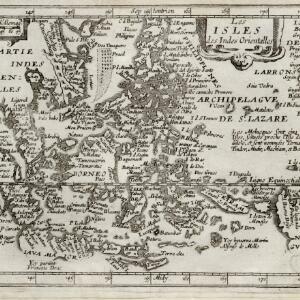
French text on the right of this map notes that the ‘Molucques’—an important region for the spice trade—were near the island of Gilolo (modern Halmahera) and names them as Ternate, Tindor (Tidore), Mutir (Moti), Machiam (Makian) and Bachian (Bacan).

Asia noviter delineata

event1640

location_onBrunei, Cambodia, East Timor, Indonesia, Laos, Malaysia, Myanmar, Philippines, Singapore, Southeast Asia, Thailand, Vietnam

This map is illustrated with drawings of Asian people wearing traditional clothing, including representatives of Sumatra, Java and the Maluku Islands. There are also drawings of important ports such as Bantam (Banten) at the western end of Java.

Asia noviter delineata

eventc.1635-1638

location_onBrunei, Cambodia, East Timor, Indonesia, Laos, Malaysia, Myanmar, Philippines, Singapore, Southeast Asia, Thailand, Vietnam

This map is illustrated with drawings of Asian people wearing traditional clothing, including representatives of Sumatra, Java and the Maluku Islands. There are also drawings of important ports such as Bantam (Banten) at the western end of Java.

close