Burma-China Boundary Commission: Reconnaissance map. Southern party
event1900
location_onMyanmar
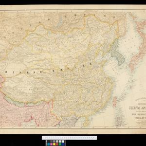
Stanford's Map of the Empires of China & Japan with the adjacent parts of the Russian Empire, India, Burma &c.
event1896
location_onMyanmar, Vietnam
Stanford's Map of the Empires of China & Japan with the adjacent parts of the Russian Empire, India, Burma &c.
event1895
location_onMyanmar, Vietnam
Map to illustrate Convention of March 1st 1894 between Great Britain and China: From the Map of Upper Burma
event1894
location_onMyanmar
Trade Routes in the Far East
event1894
location_onBrunei, Cambodia, Indonesia, Laos, Malaysia, Myanmar, Philippines, Singapore, Thailand, Vietnam
South eastern frontier: Reconnaissance survey of the route followed by Lieut. Daly's party towards the China frontier
eventc.1890-1891
location_onMyanmar
South eastern frontier
eventc.1890-1906
location_onMyanmar, Thailand
India, Burmah and the adjacent parts of Beluchistan, Afghanistan, Turkestan, the Chinese Empire, and Siam
event1887
location_onMyanmar, Thailand, Malaysia, Indonesia
Parts of Burma, Siam and the Shan States
event1886
location_onMyanmar, Thailand
The external trade routes of India: with tables showing the amount and value of the principal exports and imports of the chief Indian sea ports and frontier states
event1886
location_onMyanmar, Thailand
Map of Burmah, and adjacent countries
event1875
location_onMyanmar, Thailand
The Island of Ceylon / Burmah, Siam and Anam
event1870
location_onMyanmar, Laos, Cambodia, Thailand, Vietnam, Malaysia