Search Results

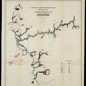
Bijdrage tot eene geologische kaart der residentie Westerafdeeling van Borneo
1858
Indonesia
A geological map of western Borneo made by a mine engineer, showing the types of soil, coal, clay, and rock (limestone, sandstone, granite, basalt), as well as gold, diamonds, tin, copper and iron found along the rivers.

Kaart van de westerhelft der residentie Rembang
1858
Indonesia
Topographic map of the residency of Rembang, Central Java, divided into regencies and districts. Roads and villages are marked, with shoals, reefs and water depth at sea. An inset map of the city of Rembang features markets, warehouses, churches.

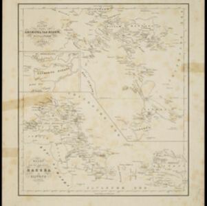
Kaart van den archipel van Riouw, Singapore en Lingga / Kaart van de eilanden Bangka en Blitong
1857
Indonesia, Singapore
Two maps featuring many of the islands between the Malay Peninsula, Sumatra and Borneo. In the top map, Batam, Bintan, Lingga and many of the smaller Riau Islands. In the bottom map, Bangka and Belitung on the east coast of Sumatra.

Ost-Indien mit den Inseln
1857
Cambodia, Brunei, East Timor, Indonesia, Laos, Malaysia, Myanmar, Philippines, Singapore, Southeast Asia, Thailand, Vietnam
On this map of India and Southeast Asia, borders are outlined and cities underlined in different colours to show the colonial territories of the European powers. Independent states such as Birma, Siam and Annam are also marked.

Die Ostindischen Inseln
1846
Brunei, Cambodia, East Timor, Indonesia, Laos, Malaysia, Myanmar, Philippines, Singapore, Southeast Asia, Thailand, Vietnam
Map of Southeast Asia highlighting the colonial possessions of the Netherlands (Dutch East Indies), Spain (Philippines), Britain (Straits Settlements, Burma, part of Borneo) and Portugal (East Timor). From the German atlas ‘Stielers Handatlas’.

Ost-Indien mit den Inseln
1857
Cambodia, Brunei, East Timor, Indonesia, Laos, Malaysia, Myanmar, Philippines, Singapore, Southeast Asia, Thailand, Vietnam
On this map of India and Southeast Asia, borders are outlined and cities underlined in different colours to show the colonial territories of the European powers. Independent states such as Birma, Siam and Annam are also marked.

Die Ostindischen Inseln
1846
Brunei, Cambodia, East Timor, Indonesia, Laos, Malaysia, Myanmar, Philippines, Singapore, Southeast Asia, Thailand, Vietnam
Map of Southeast Asia highlighting the colonial possessions of the Netherlands (Dutch East Indies), Spain (Philippines), Britain (Straits Settlements, Burma, part of Borneo) and Portugal (East Timor). From the German atlas ‘Stielers Handatlas’.

Nederlandsche overzeesche bezittingen / Oost-Indië
1856
Brunei, East Timor, Indonesia, Malaysia, Singapore
Map of the East Indies, showing Dutch colonial territory (Dutch East Indies) in the mid-19th century. Coloured borders are used to highlight internal administrative regions. Three inset maps show other Dutch territories outside Southeast Asia.
- Indonesia565
- Malaysia343
- Singapore312
- Brunei292
- Thailand289
- Vietnam282
- Cambodia277
- Myanmar277
- Philippines274
- East Timor265
- Laos252
- Southeast Asia232
- more Simple Location »
- Port61
- Railway Station25
- Pier17
- River428
- Road132
- Path88
- Postal Route57
- Railway/Tramway56
- Telegraph/Telephone20
- Canal17
- Bridge16
- Legend234
- Cartouche160
- Inset Map148
- Illustration120
- Elevation64
- Coat of Arms59
- [remove]Longitude and Latitude612
- Scale419
- Contour Lines/Elevation245
- Compass Rose197
- Written Note/Details128
- Rhumbline Network52


