Search Results
1321 Results found

Stanford's library map of Asia
1862
Brunei, Cambodia, East Timor, Indonesia, Laos, Myanmar, Malaysia, Philippines, Singapore, Southeast Asia, Thailand, Vietnam
Map of Asia on four sheets, with Southeast Asia on sheet four. British colonial territory—British Burma, the Straits Settlements, Sarawak—is highlighted in red, with the Dutch East Indies, Spanish Philippines and Portuguese East Timor also shown.

Azië : 1861
1861
Brunei, Cambodia, East Timor, Indonesia, Laos, Malaysia, Myanmar, Papua New Guinea, Philippines, Singapore, Southeast Asia, Thailand, Vietnam
Map of Asia published by the North Holland Regional Association of the Dutch Teachers' Association. Mainland Southeast Asia is labelled ‘Achter Indie [Beyond India]’; the Indonesian Archipelago is labelled ‘Indische Archipel [Indian Archipelago]’.

Asia
1860
Papua New Guinea, Brunei, Cambodia, Indonesia, Laos, Malaysia, Myanmar, Philippines, Singapore, Southeast Asia, Thailand, Vietnam
This mid-19th century map of Asia has colour-coded borders that show the beginnings of the emergence of the modern nation states of Southeast Asia, such as Laos, Burmah (Burma), Siam (Thailand) and Malaya (Malaysia).

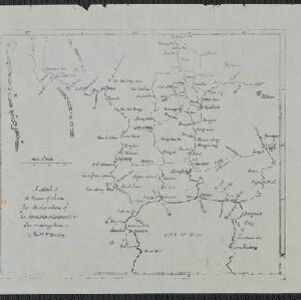
A sketch of the rivers of Siam from the observations of the American missionaries
c.1860-1869
Thailand
A sketch of the river networks discharging into the Gulf of Siam (Gulf of Thailand), derived from the observations of mid-19th century American missionaries. Settlements along the rivers are noted, as are areas where sugarcane was grown.

Kaart van de Adsistent Residentie Benkoelen en van de Eilanden Bewesten Sumatra
1860
Indonesia
Map of part of the Dutch colonial administrative region (assistant residency) of Benkoelen (Bengkulu, Sumatra), with an inset map of the Mentawai Islands. (From ‘Algemeene Atlas van Nederlandsche Indie [General Atlas of the Dutch East Indies]’.)

Kaart van de Adsistent Residentie Benkoelen: Middendeel
1860
Indonesia
Map of part of the Dutch colonial administrative region (assistant residency) of Benkoelen (Bengkulu, Sumatra). Inset map of Nias Island and the Batu Islands. (From ‘Algemeene Atlas van Nederlandsche Indie [General Atlas of the Dutch East Indies]’.)

Kaart van de Adsistent Residentie Benkoelen: Noorderdeel
1860
Indonesia
Map of part of the Dutch colonial administrative region (assistant residency) of Benkoelen (Bengkulu, Sumatra). There is an inset map of the Banyak Islands. (From ‘Algemeene Atlas van Nederlandsche Indie [General Atlas of the Dutch East Indies]’.)
- Filter from 1478 to 1900
- Indonesia1,105
- Malaysia752
- Myanmar688
- Thailand676
- Singapore664
- Vietnam628
- Cambodia620
- Brunei601
- Philippines585
- Laos570
- East Timor537
- Southeast Asia502
- more Simple Location »
- Port122
- Railway Station40
- Pier29
- River941
- Road268
- Path163
- Railway/Tramway130
- Postal Route91
- Telegraph/Telephone47
- Canal32
- Bridge24
- Legend471
- Cartouche381
- Inset Map292
- Illustration290
- Elevation134
- Coat of Arms101
- [remove]Longitude and Latitude1,321
- Scale900
- Contour Lines/Elevation480
- Compass Rose371
- Written Note/Details329
- Rhumbline Network124


