Search Results
1321 Results found

L'Asie suivant les dernres. observons. des Moscovites
1747
Brunei, Cambodia, East Timor, Indonesia, Laos, Malaysia, Myanmar, Philippines, Singapore, Southeast Asia, Thailand, Vietnam
The title of this mid-18th century map translates as ‘Asia following the latest observations of the Muscovites/Russians’. Written notes in French list the regions, islands, empires, kingdoms, colonial possessions, religions and languages of Asia.

Carte des costes de Cochin Chine, Tunquin, et partie de celles de la Chine
1747
Vietnam, Cambodia
Map of the eastern coast of mainland Southeast Asia (modern Vietnam and part of Cambodia), divided into Tsiampa, Kochinchine and Tunquin. The shoals and reefs of the Paracel Islands are marked. The text is in French and Dutch.

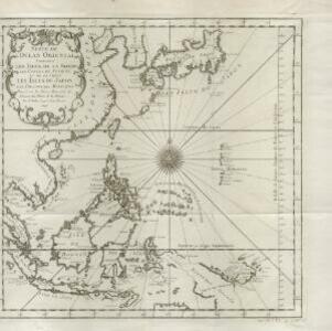
Suite de l'Ocean Oriental contenant les Isles de la Sonde, les costes de Tunquin et de la Chine, les isles du Japon, les Philippines, Moluques
1746
Brunei, Cambodia, East Timor, Indonesia, Malaysia, Papua New Guinea, Philippines, Singapore, Southeast Asia, Thailand, Vietnam
The coast of New Guinea (‘Nova Guinéa’) is represented in part by a dotted line on this mid-18th century map, indicating that the exact coastlines were unknown at this time. Originally in French, the map has been modified to add Dutch text as well.

Chart of the China Sea
1746
Brunei, Cambodia, Indonesia, Malaysia, Philippines, Vietnam
This map features eight expedition routes across the South China Sea from 1752 to 1763. The web of lines is a rhumbline network, and bathymetry (sea depth) is marked. The place names are in French, but with an English title and notes.

Suite de l'Ocean Oriental contenant les Isles de la Sonde, les costes de Tunquin et de la Chine, les isles du Japon, les Philippines, Moluques
1746
Brunei, Cambodia, East Timor, Indonesia, Malaysia, Papua New Guinea, Philippines, Singapore, Southeast Asia, Thailand, Vietnam
The coast of New Guinea (‘Nova Guinéa’) is represented in part by a dotted line on this mid-18th century map, indicating that the exact coastlines were unknown at this time. Originally in French, the map has been modified to add Dutch text as well.

Suite de l'Ocean Oriental contenant les Isles de la Sonde, les costes de Tunquin et de la Chine, les isles du Japon, les Philippines, Moluques
1746
Brunei, Cambodia, East Timor, Indonesia, Malaysia, Papua New Guinea, Philippines, Singapore, Thailand, Vietnam, Southeast Asia
The coast of New Guinea (‘Nouvelle Guinée’) is represented in part by a dotted line on this mid-18th century map, indicating that the exact coastlines were unknown at this time. The western tip is labelled ‘C. de Bonne Esperance [Cape of Good Hope]’.

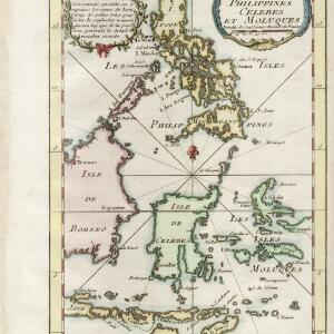
Carte des isles Philippines, Celebes et Moluques
c.1746-1770
Brunei, Malaysia, Philippines, Indonesia, East Timor
The note in French at the top left of this map states that although the map is accurate, the names of many small islands have been omitted to avoid confusion, and that more details will come later.

Carte d'Asie: dressée sur les memoires envoyéz par le Czar a l'Academie Royale des Science
1745
Brunei, Cambodia, East Timor, Indonesia, Laos, Malaysia, Myanmar, Philippines, Singapore, Southeast Asia, Thailand, Vietnam
An early 18th century map of Asia by the French cartographer Guillaume Delisle (1675–1726). Regions are indicated with coloured borders, and the southern part of Borneo is labelled ‘Côte de Mahometans [Coast of the Muslims]’.
- Filter from 1478 to 1900
- Indonesia1,105
- Malaysia752
- Myanmar688
- Thailand676
- Singapore664
- Vietnam628
- Cambodia620
- Brunei601
- Philippines585
- Laos570
- East Timor537
- Southeast Asia502
- more Simple Location »
- Port122
- Railway Station40
- Pier29
- River941
- Road268
- Path163
- Railway/Tramway130
- Postal Route91
- Telegraph/Telephone47
- Canal32
- Bridge24
- Legend471
- Cartouche381
- Inset Map292
- Illustration290
- Elevation134
- Coat of Arms101
- [remove]Longitude and Latitude1,321
- Scale900
- Contour Lines/Elevation480
- Compass Rose371
- Written Note/Details329
- Rhumbline Network124


