Search

Search Results

Nouvelle carte de l'Asie, avec des tables alphabetiques pour trouver sans peine les etats des principaux princes de cette partie du monde

event1732

location_onBrunei, Cambodia, East Timor, Indonesia, Laos, Malaysia, Myanmar, Philippines, Singapore, Southeast Asia, Thailand, Vietnam

Map showing the kingdoms, states and nations of Asia. They are listed—along with major cities and rivers—in an extensive key. Each location has a two letter code that identifies its location on the map (uppercase is longitude; lowercase is latitude).

The principal islands of the East-Indies: explaining what belongs to England, Spain and Holland &c.

event1732

location_onBrunei, Cambodia, East Timor, Indonesia, Philippines, Malaysia, Thailand, Vietnam, Singapore, Southeast Asia

The letters ‘E’ or ‘D’ are marked after place names to indicate if they are English or Dutch colonial possessions: e.g. ‘Marleborough Fort E’ on Sumatra or ‘Concordia Fort D’ on Timor. The Philippines are labelled ‘to Spain’.

Nieuwe kaart van de Sundasche eilanden als Borneo, Sumatra en Groot Iava &c.

eventc.1731-1769

location_onBrunei, Cambodia, Indonesia, Malaysia, Singapore, Thailand

On this mid-18th century map of the Sunda Islands, a label on the island of Borneo states ‘Beajous Afgoden dienars bewonende het middelste gedeelte vant Eilland [Beajous idolaters inhabit the middle part of the Island]’.

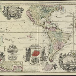
Carte nouvelle de la Mer du Sud

event1730

location_onEast Timor, Indonesia, Papua New Guinea, Philippines, Vietnam

This elaborately illustrated map of the Atlantic and Pacific Oceans includes the eastern islands of Southeast Asia. The routes of five expeditions west across the Pacific are marked, including that of Ferdinand Magellan to the Philippines in 1520.

Recentissima Asiae Delineatio: Qua Imperia eius, Regn, et Status...

event1730

location_onBrunei, Cambodia, East Timor, Indonesia, Laos, Malaysia, Myanmar, Papua New Guinea, Singapore, Philippines, Southeast Asia, Thailand, Vietnam

This map's cartouche features an illustration of three men bowing before a ruler on a throne. There is also what was probably meant to be a lion, though the poor likeness suggests it was based on written descriptions rather than real life experience.

L'Asie dressée sur les observations de Mrs. de l'Academie Royale de Sciences

event1730

location_onBrunei, Cambodia, East Timor, Indonesia, Laos, Malaysia, Myanmar, Philippines, Singapore, Southeast Asia, Thailand, Vietnam

This map features maritime routes: between Siam and Batavia; and five routes of the explorers Juan Gaetan and Olivier du Nord (dated 1542) east of the Philippines. The cartouche has a colourful illustration of Asian people in traditional costume.

Asiae recentissima delineatio, qua Status et Imperia totius Orientis unacum Orientalibus Indiis exhibentur

event1730

location_onVietnam, Myanmar, Papua New Guinea, Philippines, Singapore, Southeast Asia, Thailand, Malaysia, Laos, Indonesia, East Timor, Cambodia, Brunei

This map's cartouche features an illustration of three men bowing before a ruler on a throne. There is also what was probably meant to be a lion, though the poor likeness suggests it was based on written descriptions rather than real life experience.

Molvccae insvlae celeberrimae

eventc.1730-1778

location_onIndonesia

A map of a small island chain off the west coast of the island of Gilolo (modern Halmahera in the Maluku Islands of Indonesia). The military forts and ships were used by the European colonial powers during conflicts over the area’s spice trade.

close