Search

Search Results

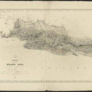
Kaart van het eiland Java

event1845

location_onIndonesia

This map of Java uses hachures: short lines/dashes that give a sense of the shape and steepness of terrain. The coast is marked with shoals and reefs (dotted lines and crosses), bathymetry (sea depth, in figures) and anchor points (anchor symbols).

Possessions Françaises orientales

eventc.1845

location_onMyanmar

Although this map focuses on French colonial possessions in Africa, the Arabian Peninsula and India, a small part of Southeast Asia is shown: labelled ‘Birmans’, it was part of the Birman Empire (modern Myanmar).

Possessions Françaises orientales

eventc.1845

location_onMyanmar

Although this map focuses on French colonial possessions in Africa, the Arabian Peninsula and India, a small part of Southeast Asia is shown: labelled ‘Birmans’, it was part of the Birman Empire (modern Myanmar).

Possessions Françaises orientales

eventc.1845

location_onMyanmar

Although this map focuses on French colonial possessions in Africa, the Arabian Peninsula and India, a small part of Southeast Asia is shown: labelled ‘Birmans’, it was part of the Birman Empire (modern Myanmar).

Possessions Françaises orientales

eventc.1845

location_onMyanmar

Although this map focuses on French colonial possessions in Africa, the Arabian Peninsula and India, a small part of Southeast Asia is shown: labelled ‘Birmans’, it was part of the Birman Empire (modern Myanmar).

close