Search Results

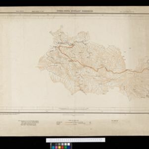
Military district no. 1: Department of northern Luzon
1900
Philippines
A map of the northwest coastal region of Luzon, Philippines made for the American military during the Philippine–American War (1899–1902). The area is divided into provinces, and major roads, settlements, mountains and rivers are marked.

Map of Asia: Printed for the New York Central's 'Four-Track Series'
1900
Malaysia, Indonesia, Thailand, Myanmar, Cambodia, Vietnam, Papua New Guinea, Philippines, Singapore, Brunei, Laos, Southeast Asia
Colonial territory is labelled and colour-coded on this map of Southeast Asia. A list on the left edge gives the colonial status, size and population of Asian countries, and ranks the main cities by population. Gold and iron mines are marked.

[Various Indonesian islands]
c.1900
Malaysia, Brunei, Indonesia, Singapore
Seven locations in the Dutch East Indies on one sheet: the islands of Borneo, Sumatra, Celebes (Sulawesi), Ambon and Banda, the city of Padang and its region on the west coast of Sumatra, and the tip of the Minahasa Peninsula (northern Celebes).

Map of the Kingdom of Siam and its dependencies
c.1900
Myanmar, Malaysia, Singapore, Thailand, Laos, Cambodia, Vietnam
The border of the Kingdom of Siam (Thailand) and its internal administrative districts are highlighted in yellow. Inset maps show the cities of Bangkok, Chiengmai (Chiang Mai) and Luang Pra Bang (Luang Prabang) in more detail.
- Filter from 1575 to 1900
- Indonesia600
- Malaysia297
- Myanmar262
- Thailand259
- Singapore242
- Vietnam238
- Cambodia223
- Laos214
- Brunei213
- Philippines205
- East Timor176
- Southeast Asia164
- more Simple Location »
- Port101
- Railway Station34
- Pier32
- River630
- Road277
- Path165
- Railway/Tramway115
- Postal Route82
- Telegraph/Telephone46
- Canal37
- Bridge35
- [remove]Mountain/Volcano742
- Jungle/Wooded Area194
- Wetlands189
- Wild Animals44
- Mangrove22
- Legend360
- Inset Map206
- Cartouche151
- Illustration128
- Elevation109
- Coat of Arms77


