
Search


Refine your results
- Filter from 1832 to 1900
Current results range from 1832 to 1900
Location
- check_box_outline_blankManila4
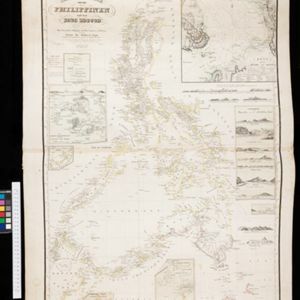
- check_box[remove]Manila Bay4
- check_box_outline_blankBorneo3
- check_box_outline_blankLuzon3
- check_box_outline_blankMindanao3
- check_box_outline_blankPalawan3
- check_box_outline_blankSulu Sea3
- check_box_outline_blankBatulakki2
- check_box_outline_blankBongo Bucht2
- check_box_outline_blankBucht von Manila2
- check_box_outline_blankCabras2
- check_box_outline_blankChinesisches Meer2
- more Detailed Location »
Land Use
- check_box_outline_blankChurch2
- check_box_outline_blankHospital2
- check_box_outline_blankMilitary Barracks2
- check_box_outline_blankCemetery/Columbarium1
- check_box_outline_blankCourt of Law1
- check_box_outline_blankMilitary Fort1
- check_box_outline_blankPalace1
- check_box_outline_blankPolice Station1
- check_box_outline_blankPublic Space1
- check_box_outline_blankResidential Area1


