Search

Search Results

Mindanao

event1900

location_onPhilippines

A map of Mindanao, Philippines made for the American military during the Philippine–American War (1899–1902). Areas are marked with the names of the local indigenous peoples. Flags indicate stations of American troops.

Military map of the Isle of Luzon

event1900

location_onPhilippines

A map of Luzon, Philippines divided into military and civilian regions. Made for the American military, it features roads, railways, telegraph lines, mountains and rivers. An inset map of Manila shows military, civil and religious buildings.

Military district no. 1: Department of northern Luzon

event1900

location_onPhilippines

A map of the northwest coastal region of Luzon, Philippines made for the American military during the Philippine–American War (1899–1902). The area is divided into provinces, and major roads, settlements, mountains and rivers are marked.

Southern Luzon

event1900

location_onPhilippines

This map of southern Luzon in the Philippines, and its associated islands, is divided into provinces, and features mountains with their heights, rivers and major settlements.

Map of Asia: Printed for the New York Central's 'Four-Track Series'

event1900

location_onMalaysia, Indonesia, Thailand, Myanmar, Cambodia, Vietnam, Papua New Guinea, Philippines, Singapore, Brunei, Laos, Southeast Asia

Colonial territory is labelled and colour-coded on this map of Southeast Asia. A list on the left edge gives the colonial status, size and population of Asian countries, and ranks the main cities by population. Gold and iron mines are marked.

Manila, sus arrabales

event1900

location_onPhilippines

A plan of the city of Manila, Philippines, showing the streets and buildings—categorised as military (coloured red), civil (yellow) or religious (blue)—around the Pasig River. The city is surrounded by suburbs, fields and wetlands.

Sketch showing positions of 1st Brigade, 2nd Division, 8th Corps, in operations against Manila

event1900

location_onPhilippines

Created by the U.S. Army, this map of a small area south of Manila records Spanish and American trenches and troop and gun locations on the last day of the Spanish–American War (13 August 1898). Ground conditions (swamps, jungle, fields) are noted.

Map of the Spanish and American trenshes on the south of Manila

eventc.1900-1909

location_onPhilippines

Created by the U.S. Army during the Spanish-American War, this reconnaissance map of a small area south of Manila features Spanish (red) and American (blue) trenches, as well as roads, buildings and ground conditions (firm ground, swamps, fields).

Eiland Sebangka

eventc.1900-1909

location_onIndonesia

Map of the island of Sebangka (Lingga Regency, off the east coast of Sumatra), spread over four sheets. It features settlements, crops and plantations, rivers, mountains (with their heights) and wetlands. Only three of four sheets are available.

[Various Indonesian islands]

eventc.1900

location_onMalaysia, Brunei, Indonesia, Singapore

Seven locations in the Dutch East Indies on one sheet: the islands of Borneo, Sumatra, Celebes (Sulawesi), Ambon and Banda, the city of Padang and its region on the west coast of Sumatra, and the tip of the Minahasa Peninsula (northern Celebes).

Burma-China Boundary Commission

event1900

location_onMyanmar

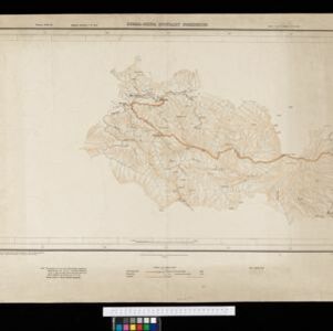
A topographic map of the Burma-China border spread over five sheets. High points are marked with their heights so they can be used for triangulation. Settlements, rivers, trade routes and footpaths are also shown.

Burma-China Boundary Commission: Reconnaissance map. Southern party

event1900

location_onMyanmar

A topographic reconnaissance map of the Burma-China border. High points are marked with their heights so they can be used for triangulation. Settlements, rivers, trade routes and footpaths are also shown.

close