Search

Search Results

Asiatic archipelago

event1832

location_onVietnam, Myanmar, Papua New Guinea, Philippines, Singapore, Southeast Asia, Thailand, Malaysia, Laos, Indonesia, East Timor, Cambodia, Brunei

This late 19th century map of Southeast Asia shows the best maritime routes around the region, according to the time of year. There is also an inset map highlighting the rivers and southern islands of Singapore.

Asien 1831

event1831

location_onBrunei, Cambodia, East Timor, Indonesia, Laos, Malaysia, Myanmar, Papua New Guinea, Philippines, Singapore, Southeast Asia, Thailand, Vietnam

On this map of Asia, borders are outlined and cities underlined in different colours to show the colonial territories of the European powers: Russian, British, Dutch, French, Spanish, Portuguese and Danish.

Carte de l'Asie

event1831

location_onBrunei, Cambodia, Indonesia, Laos, Malaysia, Myanmar, Philippines, Singapore, Thailand, Vietnam, Southeast Asia

The ancient kingdoms of mainland Southeast Asia are shown on this map of Asia, including the Birman Empire (Myanmar), the Kingdom of Siam (Thailand), and the Empire of Annam (Vietnam).

Ost-Indien mit den Inseln

event1831

location_onBrunei, Cambodia, East Timor, Indonesia, Laos, Malaysia, Myanmar, Philippines, Singapore, Southeast Asia, Thailand, Vietnam

On this map of India and Southeast Asia, borders are outlined and cities underlined in different colours to show the colonial territories of the European powers: British, Dutch, Spanish, Portuguese, French and Danish.

Die Ostindischen Inseln

event1830

location_onBrunei, Cambodia, East Timor, Indonesia, Laos, Malaysia, Myanmar, Philippines, Singapore, Southeast Asia, Thailand, Vietnam

Map of Southeast Asia highlighting European colonial possessions. Unusually, the south coast of the Philippine island of Mindanao is shown twice, reflecting uncertainty about its true location. Names of indigenous peoples are listed on Borneo.

Carte du Grand Archipel d'Asie (Partie Nord-ouest de l'Océanie)

event1826

location_onSoutheast Asia, Malaysia, Indonesia, Vietnam

Colonial possessions of the Dutch, Spanish and Portuguese, as well as lands of ‘indigenous princes’ are marked with coloured borders on this map of maritime Southeast Asia. Hot springs and mineral water springs in Java are also listed.

Asia

event1826

location_onBrunei, East Timor, Cambodia, Indonesia, Laos, Malaysia, Myanmar, Papua New Guinea, Philippines, Singapore, Southeast Asia, Thailand, Vietnam

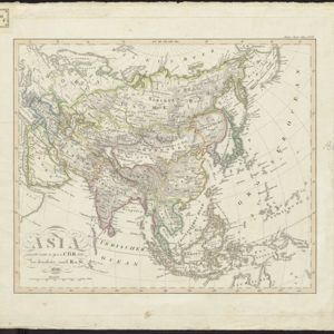
This map of Asia is from the earliest version of ‘Stielers Handatlas’ by the German cartographers Adolf Stieler and Christian Gottlieb Reichard. The maps were initially published separately; later editions compiled them into book form.

A New general map of the East Indies, exhibiting in the Peninsula on this side of the Ganges or Hindoostan, the several partitions of the Mogul's Empire

event1823

location_onMalaysia, Brunei, Indonesia, Cambodia, Thailand, Vietnam, Myanmar, Laos, Southeast Asia

This 19th century map highlights British colonial possessions in India (in red), and the various kingdoms of northern Southeast Asia, including the Birman Empire (Myanmar), Cochin China and Tonkin (Vietnam), Lao (Laos), Siam (Thailand), and Cambodia.

close