Search

Search Results

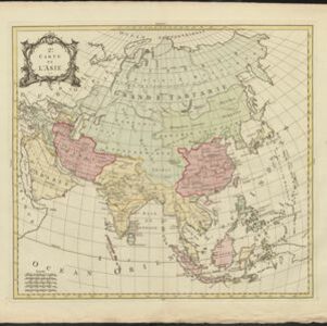
2e. carte de l'Asie

event1755

location_onBrunei, Cambodia, East Timor, Indonesia, Laos, Malaysia, Myanmar, Philippines, Singapore, Southeast Asia, Thailand, Vietnam

Mid-18th century French-language map of Asia, with Southeast Asia divided into four regions: the mainland in yellow, the Philippines in green, the Sunda Islands in red, and the Maluku Islands in yellow.

Archipel des Indes Orientales: qui comprend les Isles de la Sonde, Moluques et Philippines

event1750

location_onBrunei, Cambodia, East Timor, Indonesia, Malaysia, Philippines, Singapore, Southeast Asia, Thailand, Vietnam

This 18th century map of Southeast Asia by the French cartographer Gilles Robert de Vaugondy features the national borders of the Philippines in green, and of modern Indonesia in yellow. The Malay Peninsula and modern Cambodia and Vietnam are in red.

Carte de l'Inde au-delà du Gange comprenant les Royaumes de Siam, de Tunquin, Pegu, Ava, Aracan &c.

event1750

location_onMalaysia, Cambodia, Myanmar, Thailand, Vietnam, Laos

A mid-18th century map showing mainland Southeast Asia divided into regions such as Pegu, Ava and Aracan (Myanmar), Siam (Thailand), Laos, Camboie (Cambodia), Cochinchine and Tunquin (Vietnam), and Malaca (Malaysia).

Archipel des Indes Orientales: qui comprend les Isles de la Sonde, Moluques et Philippines

event1750

location_onBrunei, Cambodia, East Timor, Indonesia, Malaysia, Philippines, Singapore, Southeast Asia, Thailand, Vietnam

This 18th century map of Southeast Asia by the French cartographer Gilles Robert de Vaugondy features the national borders of the Philippines in green, and of modern Indonesia in yellow. The Malay Peninsula and modern Cambodia and Vietnam are in red.

Les Indes oriental et leur archipel: aßujetties aux observations astronomiques

event1750

location_onBrunei, Cambodia, East Timor, Indonesia, Laos, Malaysia, Myanmar, Philippines, Singapore, Southeast Asia, Thailand, Vietnam

This mid-18th century map of Asia has colour-coded regions, with mainland Southeast Asia and the Greater Sunda Islands bordered in blue, and India in red.

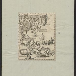
Carte a faite sur les lieux par Daniel Tavernier in plusieurs Voiages qu'il fait au Tonquin

event1679

location_onVietnam

Early map of the coast of Tunquin (modern northern Vietnam) made by the French merchant and adventurer Daniel Tavernier. It features a drawing of Poseidon/Neptune riding in a sea chariot pulled by horses, and extensive notes describing the region.

close