Search

Search Results

Nederlandsch Oost-Indië

event1865

location_onBrunei, Cambodia, East Timor, Indonesia, Laos, Malaysia, Myanmar, Vietnam, Thailand, Southeast Asia, Singapore, Philippines, Papua New Guinea

This detailed map of the Dutch East Indies in the mid-19th century contains a great deal of information: topographical details, settlements and administrative areas, roads, railways and maritime routes, telegraph lines, inset maps etc.

Chart of the China Sea

event1864

location_onPapua New Guinea, Indonesia, Malaysia, Cambodia, East Timor, Philippines, Singapore, Thailand, Vietnam

To aid navigation, this map shows small islands, shoals and reefs, maritime routes for use during monsoons or at particular times of the year, bathymetry (sea depth), tide information, shipwrecks, compass roses and landmark mountains at the coasts.

Eastern Islands: Birmah &c.

event1846

location_onBrunei, Cambodia, East Timor, Indonesia, Laos, Malaysia, Myanmar, Philippines, Singapore, Southeast Asia, Thailand, Vietnam

On this map of Southeast Asia, British colonial territory is highlighted within red borders: the Straits Settlements (Singapore, Malacca and Penang) on the west coast of the Malay Peninsula; and British Burma (Chittagong and Aracan, and Tenasserim).

Map of the Burman Empire including also Siam, Cochin-China, Ton-king and Malaya

event1842

location_onVietnam, Malaysia, Myanmar, Cambodia, Thailand, Laos, Indonesia, Singapore, Brunei

Although this mid-19th century map covers all of mainland Southeast Asia, the Burman Empire (Myanmar) is shown in greater detail, especially its districts, rivers and place names. It was produced by the James Wyld, geographer to Queen Victoria.

Map of the Burman Empire including also Siam, Cochin-China, Ton-king and Malaya

event1842

location_onVietnam, Myanmar, Malaysia, Indonesia, Thailand, Laos, Cambodia, Brunei, Singapore

Regional borders are colour-coded on this mid-19th century map of mainland Southeast Asia, with British colonial territory in red (including part of the Burman Empire, the Straits Settlements, and Sarawak on Borneo).

Map of the Burman Empire including also Siam, Cochin-China, Ton-king and Malaya

eventc.1840-1852

location_onVietnam, Malaysia, Myanmar, Cambodia, Thailand, Laos, Singapore, Brunei

Although this mid-19th century map covers all of mainland Southeast Asia, the Burman Empire (Myanmar) is shown in greater detail, especially its districts, rivers and place names. It was produced by the James Wyld, geographer to Queen Victoria.

China, Birmah and Anam

event1835

location_onCambodia, Laos, Myanmar, Thailand, Vietnam, Philippines

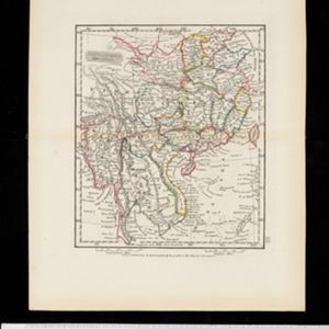
Coloured borders are used on this map to divide mainland Southeast Asia into empires and kingdoms. Mountains, rivers and major settlements are shown in land, with islands, shoals and reefs marked in the South China Sea.

Map of the Burman Empire including also Siam, Cochin-China, Ton-king and Malaya

event1832

location_onVietnam, Myanmar, Malaysia, Indonesia, Thailand, Laos, Cambodia, Brunei, Singapore

Regional borders are colour-coded on this mid-19th century map of mainland Southeast Asia, with British colonial territory in red (including part of the Burman Empire, the Straits Settlements, and Sarawak on Borneo).

East Indies

eventc.1800-1899

location_onBrunei, Cambodia, East Timor, Indonesia, Laos, Malaysia, Myanmar, Philippines, Singapore, Southeast Asia, Thailand, Vietnam

Longitude is indicated in two different ways on this mid-18th century map: along the top border, it is shown in degrees (number of degrees east of London); more unusually, along the bottom border, it is shown in time (number of hours east of London).

The East India Islands: comprehending the Isles of Sunda, the Moluccas and the Philippine Islands

event1789

location_onBrunei, Cambodia, East Timor, Indonesia, Laos, Malaysia, Myanmar, Philippines, Singapore, Southeast Asia, Thailand, Vietnam

Labels on this late 18th century map of Southeast Asia describe two indigenous populations—the ‘Kemoy’ of the mountains along the border of Cochin China (Vietnam) and Camboja (Cambodia), and the ‘Biayos’ of central Borneo—as ‘a wild Nation’.

La Presqu'isle de l'Inde au delà du Gange, avec l'Archipel des Indes. Partie occidentale

event1785

location_onBrunei, Cambodia, Indonesia, Laos, Malaysia, Myanmar, Singapore, Thailand, Vietnam

In the 18th century, European maps tended to use their own country’s meridian, so on this French map of Southeast Asia longitude is measured from the Paris Meridian. Eleven different scales are also shown.

Present Asia

event1783

location_onVietnam, Myanmar, Philippines, Singapore, Southeast Asia, Thailand, Malaysia, Laos, Indonesia, East Timor, Cambodia, Brunei

Coloured borders divide this late 18th century map of Asia into empires, kingdoms and regions. Five major rivers that flow south through mainland Southeast Asia are named: Aua, Pegu, Tenasserim, Menan and Camboya.

close