Search Results

Chart of the China Sea
1864
Papua New Guinea, Indonesia, Malaysia, Cambodia, East Timor, Philippines, Singapore, Thailand, Vietnam
To aid navigation, this map shows small islands, shoals and reefs, maritime routes for use during monsoons or at particular times of the year, bathymetry (sea depth), tide information, shipwrecks, compass roses and landmark mountains at the coasts.

A map of the East-Indies and the adjacent countries: with the settlements, factories and territories, explaning what belongs to England, Spain, France, Holland, Denmark, Portugal &c.
1720
Brunei, Cambodia, East Timor, Indonesia, Laos, Malaysia, Myanmar, Philippines, Vietnam, Thailand, Southeast Asia, Singapore
This map showcases the colonial territories of Southeast Asia in the 18th century, with text detailing trading information and the products of each region. There are five inset maps featuring plans of specific trading ports.

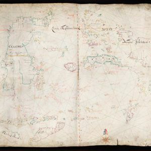
[Dutch portolan chart of the eastern Dutch East Indies]
1700
Indonesia, East Timor
This colourful hand-drawn portolan (nautical) chart was designed to aid navigation. It features a rhumbline network (the web of interconnected lines), bathymetry (sea depth), shoals and reefs, anchor points and written notes.


