
Search Results


Insularum Indiæ orientalis nova descriptio
c.1700
Brunei, Cambodia, East Timor, Indonesia, Laos, Malaysia, Myanmar, Philippines, Singapore, Southeast Asia, Thailand, Vietnam
The outline of the island of New Guinea is very vague on this early 17th century map of Southeast Asia. The cartouche is decorated with two figures of Asian warriors: one holds a spear, the other a sword. There are also drawings of mermaids.
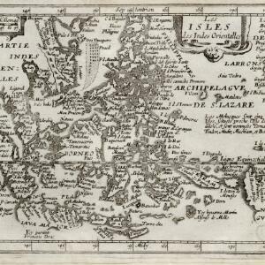
Les isles des Indes orientalles
1643
Brunei, Cambodia, East Timor, Indonesia, Laos, Malaysia, Myanmar, Philippines, Singapore, Southeast Asia, Thailand, Vietnam
French text on the right of this map notes that the ‘Molucques’—an important region for the spice trade—were near the island of Gilolo (modern Halmahera) and names them as Ternate, Tindor (Tidore), Mutir (Moti), Machiam (Makian) and Bachian (Bacan).
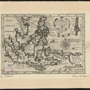
Insulae Indiae orientalis
1634
Brunei, Cambodia, East Timor, Indonesia, Laos, Malaysia, Myanmar, Philippines, Singapore, Southeast Asia, Thailand, Vietnam
On this early 17th century map of maritime Southeast Asia, the southern coast of Java ('Iava Maior') is represented by a dotted line, indicating that the exact coastline was unknown at this time.

Indiae Orientalis nova descriptio
c.1633-1636
Brunei, Cambodia, East Timor, Indonesia, Laos, Malaysia, Myanmar, Philippines, Singapore, Southeast Asia, Thailand, Vietnam
The outline of the island of New Guinea is very vague on this early 17th century map of Southeast Asia. The cartouche is decorated with two figures of Asian warriors: one holds a spear, the other a sword. There are also drawings of mermaids.


Exacta & accurata delineatio cum orarum maritimarum tum etiam locorum terrestrium quae in regionibus China, Cauchinchina, Camboia sive Champa, Syao, Malacca, Aracan & Pegu
1598
Brunei, Cambodia, East Timor, Indonesia, Laos, Malaysia, Myanmar, Philippines, Singapore, Southeast Asia, Thailand, Vietnam
Unusually, north is located to the left of this map of East Asia, rather than the top. The text notes that shallows and reefs are marked, and that the map is based on the explorations of Portuguese ships. Illustrations include sea monsters and ships.


