Search

Search Results

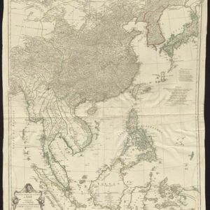
Carte generale de l'Asie: où se trouvent les découvertes faites par Bougainville, Dampier et La Pérouse

event1833

location_onBrunei, Cambodia, East Timor, Indonesia, Laos, Malaysia, Myanmar, Papua New Guinea, Philippines, Singapore, Southeast Asia, Thailand, Vietnam

This map of Asia is marked with the routes taken through Southeast Asia by the British Royal Navy captain James Cook, and the French explorer Lapérouse. The title also refers to two other explorers: Louis Antoine de Bougainville and William Dampier.

Second part of a map of Asia: containing China, part of Tartary, and India beyond the Ganges, with the isles of Sunda, Phillipiines, Moluccas and Japon

event1791

location_onBrunei, Cambodia, East Timor, Indonesia, Laos, Malaysia, Myanmar, Philippines, Singapore, Southeast Asia, Thailand, Vietnam

Although the title is in English, all the other text on this map of Southeast Asia is in French (and versions with French titles were also produced). Hand-coloured regional borders, rivers and settlements are featured.

Asie

eventc.1790

location_onBrunei, East Timor, Cambodia, Indonesia, Laos, Malaysia, Myanmar, Philippines, Singapore, Southeast Asia, Thailand, Vietnam

This map of Asia features four different scales: French, Russian, Turkish and Chinese. Each country had their own measuring system, so this was not uncommon at the time.

Les Indes orientales et leur archipel

event1785

location_onBrunei, Cambodia, East Timor, Indonesia, Laos, Malaysia, Myanmar, Philippines, Singapore, Southeast Asia, Thailand, Vietnam

A piece of paper printed with a list of the various regions of Asia, including the regions of Southeast Asia, has been adhered to the right-hand side of this late 18th century map of Asia.

L'Asie divisée en ses Empires et Royaumes

event1778

location_onBrunei, Cambodia, East Timor, Indonesia, Laos, Malaysia, Myanmar, Philippines, Singapore, Southeast Asia, Thailand, Vietnam

This map shows the empires and kingdoms of Southeast Asia. Its decorative cartouche features drawings of plants, a camel, a vase, and the heads of children blowing to represent wind. An inset shows tall buildings, possibly Asian temples.

Carte d'une partie de la Chine, les Isles Philippines, de la Sonde, Moluques, de Papoesi, &c.

event1758

location_onBrunei, Cambodia, East Timor, Indonesia, Laos, Malaysia, Myanmar, Philippines, Singapore, Southeast Asia, Thailand, Vietnam

There are some labels on this mid-18th century map of Southeast Asia describing the local populations, including the Ke-moy, a ‘Nation sauvage [savage people]’ living in the mountains on the border of Cochinchine (Vietnam) and Camboja (Cambodia).

Seconde partie de la carte d'Asie: contenant la Chine et partie de la Tartarie, l'Inde au delà du Gange, les isles Sumatra, Java, Borneo, Moluques, Philippines et du Japon

event1752

location_onBrunei, Cambodia, East Timor, Indonesia, Laos, Malaysia, Myanmar, Vietnam, Thailand, Southeast Asia, Singapore, Philippines

Labels on this mid-18th century map of Southeast Asia describe various local peoples as ‘sauvage [savage]’, including the ‘Ke-Moy’ of the mountains along the border of Cochinchine (Vietnam) and Camboja (Cambodia), and the ‘Biayos’ of central Borneo.

Seconde partie de la carte d'Asie: contenant la Chine et partie de la Tartarie, l'Inde au delà du Gange, les isles Sumatra, Java, Borneo, Moluques, Philippines et du Japon

event1752

location_onVietnam, Myanmar, Malaysia, Philippines, Singapore, Southeast Asia, Thailand, Laos, Indonesia, East Timor, Cambodia, Brunei

Labels on this mid-18th century map of Southeast Asia describe various local peoples as ‘sauvage [savage]’, including the ‘Ke-Moy’ of the mountains along the border of Cochinchine (Vietnam) and Camboja (Cambodia), and the ‘Biayos’ of central Borneo.

Seconde partie de la carte d'Asie: contenant la Chine et partie de la Tartarie, l'Inde au delà du Gange, les isles Sumatra, Java, Borneo, Moluques, Philippines et du Japon

event1752

location_onBrunei, Cambodia, East Timor, Indonesia, Laos, Malaysia, Myanmar, Vietnam, Thailand, Southeast Asia, Singapore, Philippines

Labels on this mid-18th century map of Southeast Asia describe various local peoples as ‘sauvage [savage]’, including the ‘Ke-Moy’ of the mountains along the border of Cochinchine (Vietnam) and Camboja (Cambodia), and the ‘Biayos’ of central Borneo.

close