Search

Search Results

A sketch map of the East Indian possessions of the Netherlands

event1886

location_onBrunei, Indonesia, Malaysia, Papua New Guinea, Philippines, Singapore

Produced by the Intelligence Branch of the British War Office, this map shows Dutch colonial territories in maritime Southeast Asia, and their political and military divisions in Java and Madura. British and Spanish territories are also marked.

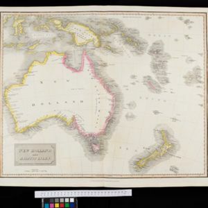
New Holland and Asiatic Isles

event1829

location_onIndonesia, East Timor, Papua New Guinea

Includes part of maritime Southeast Asia. New Guinea is labelled as ‘discovered in 1527’—a reference to the Portuguese explorer Jorge de Menezes—with additional labels describing the terrain (‘Very low land’, ‘Coast is not well known’, ‘An Opening’).

New Holland and Asiatic Isles

event1814

location_onIndonesia, East Timor, Papua New Guinea

Includes part of maritime Southeast Asia. New Guinea is labelled as ‘discovered in 1527’—a reference to the Portuguese explorer Jorge de Menezes—with additional labels describing the terrain (‘Very low land’, ‘Coast is not well known’, ‘An Opening’).

Insvlae Molvccae

event1598

location_onBrunei, Cambodia, East Timor, Indonesia, Laos, Malaysia, Papua New Guinea, Philippines, Singapore, Southeast Asia, Thailand, Vietnam

A map featuring drawings of plants used to make spices in the Moluccas or Spice Islands: Nux Myristica (nutmeg), Cariophilorum arbor (cloves), Santalum flavum (yellow sandalwood), Santalum rubrum (red sandalwood), Santalum album (Indian sandalwood).

close