Search

Search Results

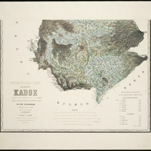
Topographische kaart der residentie Kadoe

event1870

location_onIndonesia

The residency of Kadoe (Kadu), Central Java, is shown divided into regencies and districts, with population figures for each district. Villages (kampongs) and towns, fields, mountains, rivers and roads are marked. There is an inset triangulation map.

Topographische kaart der residentie Japara

event1870

location_onIndonesia

Four-sheet topographic map of the residency of Japara (Jepara, Central Java), with an inset signal map of locations’ heights and distances. Administrative districts, crops—coffee, alang-alang, rice, sugarcane, coconut—and fishing ponds are shown.

Topographische kaart der residentie Djokjakarta

event1870

location_onIndonesia

The residency of Djokjakarta (Yogyakarta), southern Java, featuring crops (coffee, sugar, rice, alang-alang, tobacco, indigo plants, nipa palm, bamboo); warehouses, cemeteries, post offices; routes, administrative borders; mountains, rivers.

Topographische kaart der residentie Tagal

event1870

location_onIndonesia

The lower half of this two-sheet topographic map of the residency of Tagal (Tegal, Central Java) is dominated by mountains, with the upper half split between forests and rice paddies, and the larger settlements near the coast.

Topographische kaart der residentie Soerakarta

event1867

location_onIndonesia

The residency of Soerakarta (Surakarta), Central Java, featuring crops (coffee, sugarcane, rice, sugar); warehouses (coffee, sugar, tobacco, indigo plant); factories (sugar, tobacco, indigo plant); routes (railway, postal, road).

Plattegrond der stad Soerabaija

event1867

location_onIndonesia

A mid-19th century map of the city of Soerabaija (Surabaya, East Java, Indonesia) showing its recently built defences, including the ‘Citadel Prins Hendrik’ fort and a walled moat. Outside the city are villages, plantations and fields.

Plattegrond der stad Batavia

event1866

location_onIndonesia

A mid-19th century map of the important port of Batavia (Jakarta), with its pier, commercial centre and residential streets. However, the city is also surrounded by villages (kampongs), fields and plantations. An inset map shows Batavia Castle.

Nederlandsch Oost-Indië

event1865

location_onBrunei, Cambodia, East Timor, Indonesia, Laos, Malaysia, Myanmar, Vietnam, Thailand, Southeast Asia, Singapore, Philippines, Papua New Guinea

This detailed map of the Dutch East Indies in the mid-19th century contains a great deal of information: topographical details, settlements and administrative areas, roads, railways and maritime routes, telegraph lines, inset maps etc.

Kaart van de Zuider- en Ooster Afdeeling van Borneo

eventc.1865

location_onIndonesia

Map of the South and East Department of Borneo, focusing on the rivers and settlements along the rivers. The names of local districts are also printed on the map.

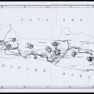
Eiland Java: aanwijzing der geprojecteerde Spoorweglijnen

event1863

location_onIndonesia

The thick black lines on this map represent proposed routes for new railway lines in mid-19th century Java. The island is divided into administrative regions, with significant mountains and rivers marked.

Topographische kaart van de residentie Banjoemaas

event1861

location_onIndonesia

The residency of Banjoemaas (Banyumas), Central Java, featuring plantations (bamboo, teakwood, coconut, coffee, cinnamon) and rice; routes (road, postal), administrative borders; mountains, rivers, wetlands, forests.

Topographische kaart der residentie Bagelen

event1860

location_onIndonesia

The residency of Bagelen, Central Java, is shown divided into regencies and districts. Coffee, tea and cinnamon plantations, fields of rice, alang-alang and other crops, mountains, rivers, hot and mineral springs, settlements and routes are marked.

close