Search

Search Results

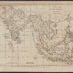
A map of the East Indies

event1780

location_onEast Timor, Southeast Asia, Brunei, Cambodia, Indonesia, Laos, Malaysia, Myanmar, Philippines, Thailand, Vietnam, Singapore

A 19th century map concentrating on Southeast Asia and India. The island of Borneo is annotated with the text 'The Inland Part of this Island is inhabited by the Biayos a savage People'.

A map of the East Indies, from the best authorities

event1780

location_onBrunei, Cambodia, East Timor, Indonesia, Laos, Malaysia, Myanmar, Philippines, Singapore, Southeast Asia, Thailand, Vietnam

On this map of Asia, Borneo is labelled ‘The Inland Part of this Island is inhabited by the Biayos a savage People’, a description seen on many contemporary maps. The ancient kingdoms of mainland Southeast Asia are also shown.

Les Isles Philippines, celle de Formose, le sud de la Chine, les Royaumes de Tunkin, de Cochinchine, de Cambodge, de Siam, des Laos: avec partie de ceux de Pegu et d'Ava

event1780

location_onIndonesia, Cambodia, Laos, Malaysia, Myanmar, Philippines, Thailand, Vietnam

Coloured borders on this map show the kingdoms of mainland Southeast Asia and the Philippines. Arrows marked on the sea to the west of the Philippines indicate wind direction during the monsoon seasons (with the months marked in French).

I. Timor

event1780

location_onIndonesia

The many navigation aids marked on this map, including bathymetry (sea depth), anchor points, shoals, and elevations of hills, were designed to guide ships around this part of the west coast of Timor. The Dutch fort Concordia is also marked.

close