Search

Search Results

Nieuwe en naukeurige kaart der Oost-Indische Eilanden

eventc.1770

location_onBrunei, Cambodia, East Timor, Indonesia, Laos, Malaysia, Myanmar, Philippines, Singapore, Southeast Asia, Thailand, Vietnam

Some regions on this map of Southeast have a descriptive label: Sumatra is described as having mines of gold, silver, iron, and sulphur; and elephants, tigers, rhinoceroses, dragons and crocodiles. Gilolo has rice, sago and turtles. Ambon has nutmeg.

East Indies

event1769

location_onBrunei, Cambodia, East Timor, Indonesia, Laos, Malaysia, Myanmar, Philippines, Singapore, Southeast Asia, Thailand, Vietnam

Longitude is indicated in two different ways on this mid-18th century map: along the top border, it is shown in degrees (number of degrees east of London); more unusually, along the bottom border, it is shown in time (number of hours east of London).

A chart of the seas between the Straits of Banca and Po. Timon: with the eastern part of the Straits of Malacca

event1767

location_onIndonesia, Malaysia

This mid-18th century maritime map charts the seas between Peninsula Malaysia and Sumatra, including Singapore—named ‘Po. Panjang’—with the old and new Straits of Singapore marked. The numbers indicate sea depth (bathymetry).

Carte de l'Isle de Sumatra

event1764

location_onMalaysia, Indonesia, Singapore

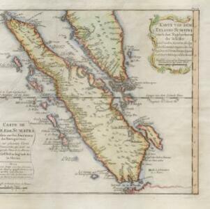
This mid-18th century map shows the island of Sumatra and the Malay Peninsula, divided by the Straits of Malacca. A note in French at the top right corner states that the interior of Sumatra and the course of its rivers are unknown.

Karte von dem eylande Sumatra nach den tagebüchern der schiffer

event1764

location_onMalaysia, Indonesia, Singapore

The title of this mid-18th century map of Sumatra and the Malay Peninsula claims that it was based on the diaries of sailors. Interestingly, the title is repeated in both German and French, as are the names of some of the locations marked on the map.

Carte de l'isle Celebes ou Macassar

event1763

location_onIndonesia

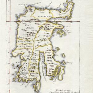
This mid-18th century map of Celebes (Sulawasi) shows the island divided into approximately a dozen separate kingdoms. The Gulf of Saleyer is noted as being ‘rempli de Bancs de Sable [filled with sandbanks]’.

Carte d'une partie de la Chine, les Isles Philippines, de la Sonde, Moluques, de Papoesi, &c.

event1758

location_onBrunei, Cambodia, East Timor, Indonesia, Laos, Malaysia, Myanmar, Philippines, Singapore, Southeast Asia, Thailand, Vietnam

There are some labels on this mid-18th century map of Southeast Asia describing the local populations, including the Ke-moy, a ‘Nation sauvage [savage people]’ living in the mountains on the border of Cochinchine (Vietnam) and Camboja (Cambodia).

East India islands

event1758

location_onBrunei, East Timor, Indonesia, Malaysia, Philippines, Singapore

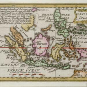
Text on this mid-18th century map notes the dimensions of the islands of maritime Southeast Asia, in length, breadth and square miles (e.g. ‘Java 580 long, 105 broad, & 38,250 sq.’). It also states that the Dutch are the main traders in the region.

Archipel des Indes Orientales: qui comprend les Isles de la Sonde, Moluques et Philippines

eventc.1757-1786

location_onBrunei, Cambodia, East Timor, Indonesia, Malaysia, Philippines, Singapore, Thailand, Vietnam, Southeast Asia

This 18th century map of Southeast Asia by the French cartographer Gilles Robert de Vaugondy features the national borders of the Philippines in green, and of modern Indonesia in yellow. The Malay Peninsula and modern Cambodia and Vietnam are in red.

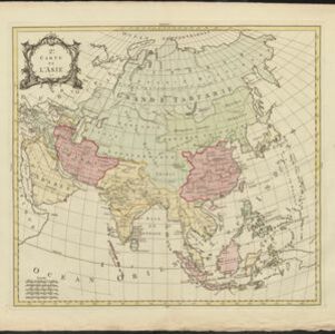
2e. carte de l'Asie

event1755

location_onBrunei, Cambodia, East Timor, Indonesia, Laos, Malaysia, Myanmar, Philippines, Singapore, Southeast Asia, Thailand, Vietnam

Mid-18th century French-language map of Asia, with Southeast Asia divided into four regions: the mainland in yellow, the Philippines in green, the Sunda Islands in red, and the Maluku Islands in yellow.

Carte du Cours de la Riviere de Tunquin: depuis Cacho jusqu'à La Mer

event1755

location_onVietnam

Map of the Tunquin River (Red or Hong River) from the city of Cacho (Hanoi, Thailand) to its mouth. At the mouth, bathymetry (sea depth), shoals and anchor points are marked. A place named Hean is labelled as an English and French trading post.

close