Search Results

Riouw archipel: Straat Doerian en oostelijke vaarwaters
1899
Indonesia
Navigation map of the waters and straits around some of the islands of the Riau Archipelago, between Sumatra and Batam. Bathymetry (sea depth), current and tide data, reefs, shoals and other obstructions (clay, mud, shells, stones, sand) are marked.

Vaarwaters en ankerplaatsen op de oostkust van Borneo: Blad III
1899
Indonesia
Navigation maps of two bays on the southeast coast of Borneo. Anchorages, bathymetry (sea depth), buoys, shoals and other obstructions are shown. There is an inset map of the roadstead—a body of water sheltered from tides/currents—at Balikpapan Bay.

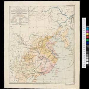
Sketch map of China and adjoining regions: showing the density of population, mineral resources, chief products, principal trade routes, existing and projected railways, and inland navigation
1898
Myanmar, Thailand, Vietnam
This map of China features a small part of northeastern Southeast Asia. Population density is shown, along with rivers, trade routes, tidal river navigation limits, railways (existing and suggested), and two coal mines in Tong-King (Vietnam).

Riouw archipel: Straat Doerian en oostelijke vaarwaters
1898
Indonesia
Navigation map of the waters and straits around some of the islands of the Riau Archipelago, between Sumatra and Batam. Bathymetry (sea depth), current and tide data, reefs, shoals and other obstructions (clay, mud, shells, stones, sand) are marked.

Noordkust Java: Westervaarwater van Soerabaja
1898
Indonesia
This map of the Madura Strait between Java and Madura is designed to aid navigation: bathymetry (water depth), lighthouses, shoals and reefs, rocks and mud, anchor points, and landmark mountains are all marked. Text describes the tidal conditions.

Westkust Celebes: Vaarwaters benoorden Makasser: Blad II
1898
Indonesia
Navigation map of the west coast of Celebes (Sulawesi), north of Makassar. Bathymetry (sea depth), shoals and other obstructions are marked, with hills and settlements as landmarks, and elevations (side views of hills) to aid navigation.


