Search

Search Results

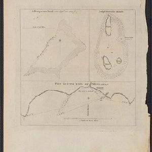
A dangerous shoal seen Septr. the 28, 1767 (Joseph Freewills Islands)

event1773

location_onPhilippines, Indonesia

These three maps are marked with shoals, rocks, water depth, safe entry points, and anchorage locations, to help ships safely anchor. The sites include the Joseph Freewill Islands (Mapia Atoll, Indonesia) and the coast of Mindanao in the Philippines.

Carte des costes de Cochin Chine, Tunquin, et partie de celles de la Chine

event1773

location_onVietnam, Cambodia

Map of the eastern coast of mainland Southeast Asia (modern Vietnam and part of Cambodia), divided into Tsiampa and Kochinchine (yellow) and Tunquin (green). The shoals and reefs of the Paracel Islands are marked. The text is in French and Dutch.

Nieuwe en naukeurige kaart van Asia

event1773

location_onIndonesia, Brunei, Cambodia, East Timor, Laos, Malaysia, Myanmar, Papua New Guinea, Philippines, Singapore, Southeast Asia, Thailand, Vietnam

Map of Asia featuring an early—and very vague—depiction of New Britain (‘Nieuw Brittanje’) which was named by the British explorer William Dampier when he visited in 1700. The ‘Straat van Dampier’ is also shown, dividing New Britain from New Guinea.

close