Search Results

Presqu'Isle de l'Inde au dela du Gange, ou sont les Rmes. d'Ava, de Siam, de Tong-King, de Cochinchine, de Camboge &c.
c.1770-1779
Brunei, Cambodia, Indonesia, Laos, Malaysia, Myanmar, Singapore, Thailand, Vietnam
On this late 18th century map, the modern nation states of mainland Southeast Asia can be seen emerging: Myanmar (here labelled Ava), Laos, Vietnam (Tong-King and Cochinchine), Cambodia (Camboge), Thailand (Siam) and Malaysia (Malaca).

Nieuwe en naukeurige kaart der Oost-Indische Eilanden
c.1770
Brunei, Cambodia, East Timor, Indonesia, Laos, Malaysia, Myanmar, Philippines, Singapore, Southeast Asia, Thailand, Vietnam
Some regions on this map of Southeast have a descriptive label: Sumatra is described as having mines of gold, silver, iron, and sulphur; and elephants, tigers, rhinoceroses, dragons and crocodiles. Gilolo has rice, sago and turtles. Ambon has nutmeg.

The Sunda Islands vitz Borneo, Sumatra and Java &c. agreable to Modern History
1770
Malaysia, Indonesia, Singapore
This map of the Sunda Islands features three different locations for the city of Palembang. ‘Palambam’ is in the correct location on Sumatra, while ‘Palimbam’ is in west Java, and ‘Palambang’ is in east Java, a confusion often seen at this time.

East Indies
1769
Brunei, Cambodia, East Timor, Indonesia, Laos, Malaysia, Myanmar, Philippines, Singapore, Southeast Asia, Thailand, Vietnam
Longitude is indicated in two different ways on this mid-18th century map: along the top border, it is shown in degrees (number of degrees east of London); more unusually, along the bottom border, it is shown in time (number of hours east of London).

A chart of the seas between the Straits of Banca and Po. Timon: with the eastern part of the Straits of Malacca
1767
Indonesia, Malaysia
This mid-18th century maritime map charts the seas between Peninsula Malaysia and Sumatra, including Singapore—named ‘Po. Panjang’—with the old and new Straits of Singapore marked. The numbers indicate sea depth (bathymetry).

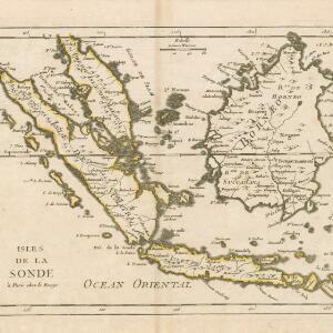
Isles de la Sonde
1767
Brunei, Indonesia, Malaysia, Singapore
Three of the larger Sunda Islands—Sumatra, Java and Borneo—are shown on this mid-18th century map, along with a few of the smaller islands such as Bali, Lombok and Sumbawa. Celebes (Sulawesi) and some of the other smaller islands are not included.

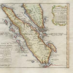
Karte von dem eylande Sumatra nach den tagebüchern der schiffer
1764
Malaysia, Indonesia, Singapore
The title of this mid-18th century map of Sumatra and the Malay Peninsula claims that it was based on the diaries of sailors. Interestingly, the title is repeated in both German and French, as are the names of some of the locations marked on the map.

Plan de l'Isle Onrust = Grondtékening van 't Eiland Onrust
1760
Indonesia
Map of the Dutch town and naval base on the island of Onrust in Batavia (Jakarta) Bay, featuring the dock at the south, and various other buildings. There are defences around the north and east coasts, and internal walls around the main buildings.
- Filter from 1535 to 1900
- Indonesia904
- Malaysia459
- Myanmar427
- Thailand419
- Singapore385
- Vietnam382
- Cambodia359
- Brunei339
- Philippines337
- Laos335
- East Timor295
- Southeast Asia277
- more Simple Location »
- Port173
- Pier74
- Railway Station56
- River884
- Road377
- Path201
- Railway/Tramway177
- Postal Route92
- Canal83
- Bridge69
- Telegraph/Telephone60
- Legend524
- Inset Map276
- Cartouche249
- Illustration189
- Elevation115
- Coat of Arms106


