Search Results

Map of the Johore Territory 1893
1894
Malaysia, Singapore
Map of the Malay state of Johor, and Singapore. The route of a proposed railway north from Johor Bahru is shown. Apart from rivers and mountains, much of the terrain is blank, with labels such as ‘Unexplored Hill Country’ or ‘Dense Jungle and Swamp’.

Trade Routes in the Far East
1894
Brunei, Cambodia, Indonesia, Laos, Malaysia, Myanmar, Philippines, Singapore, Thailand, Vietnam
Map of stream ship trade routes around Southeast Asia. Rivers, railways, submarine telegraph cables, lighthouses (fixed, revolving and flashing), graving docks and coaling stations are marked. An inset map shows a railway route from Britain to Asia.

Queensland & British New Guinea
c.1894-1897
Indonesia, Papua New Guinea
The first two sheets of this eight-sheet map focus on British New Guinea, with German and Dutch colonial areas of New Guinea also shown in part. There is a line marking a proposed change in border between Dutch and British territory.

Oostkust Sumatra. Schetskaart der Siak Rivier van het Eiland Tengah tot Siak
1894
Indonesia
This late 19th century large-scale (1:30,000) map show just a section of the Siak River, in the Riau province of Sumatra. Bathymetry (water depth) is shown in figures to aid navigation, with various landmarks noted along the river’s banks.

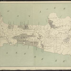
Kaart van Java: Waarop met arceeringen zyn aangeduid de streken waarop het einde van 1891 opnemingen op irrigatie gebied onderhanden warin / Waarop is aangegeven een ontwerp verdeeling in irrigatie afdeelingen
1893
Indonesia
Two maps about irrigation systems on Java. The first shows areas where systems are in place or being created, with their size. The second map shows Java divided into irrigation departments (both on trial and in operation).

Zuidelijk gedeelte van de Chineesche zee: Blad I
1893
Malaysia, Indonesia, Singapore
Navigation map of the southern part of the South China Sea, including the straits of Malacca and Singapore, and the Riau Archipelago. Bathymetry (sea depth), lighthouses, shoals and other obstructions are marked, with hills to use as landmarks.

Noordwestkust Sumatra: Van Roesa to de Bocht van Pedir
1893
Indonesia
A navigation map of the northern tip of Sumatra, featuring bathymetry (sea depth), reefs, shoals, and side views of landmark mountains (elevations). Lighthouses are highlighted in red and yellow, with lines to indicate the limits of their range.

Overzichtskaart en bladwijzer van de residentie Kediri
1893
Indonesia
This overview map of the residency of Kediri (East Java, Indonesia) features roads, railways and paths. It is divided into five regencies, which are subdivided into 28 districts, which are numbered and listed. Major settlements are also marked.
- Filter from 1535 to 1900
- Indonesia904
- Malaysia459
- Myanmar427
- Thailand419
- Singapore385
- Vietnam382
- Cambodia359
- Brunei339
- Philippines337
- Laos335
- East Timor295
- Southeast Asia277
- more Simple Location »
- Port173
- Pier74
- Railway Station56
- River884
- Road377
- Path201
- Railway/Tramway177
- Postal Route92
- Canal83
- Bridge69
- Telegraph/Telephone60
- Legend524
- Inset Map276
- Cartouche249
- Illustration189
- Elevation115
- Coat of Arms106


