Search

Search Results

Carte du Grand Archipel d'Asie (Partie Nord-ouest de l'Océanie)

event1826

location_onSoutheast Asia, Malaysia, Indonesia, Vietnam

Colonial possessions of the Dutch, Spanish and Portuguese, as well as lands of ‘indigenous princes’ are marked with coloured borders on this map of maritime Southeast Asia. Hot springs and mineral water springs in Java are also listed.

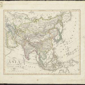
Asia

event1826

location_onBrunei, East Timor, Cambodia, Indonesia, Laos, Malaysia, Myanmar, Papua New Guinea, Philippines, Singapore, Southeast Asia, Thailand, Vietnam

This map of Asia is from the earliest version of ‘Stielers Handatlas’ by the German cartographers Adolf Stieler and Christian Gottlieb Reichard. The maps were initially published separately; later editions compiled them into book form.

Kaart van Soerabaia 1825

event1825

location_onIndonesia

This map of the city of Soerabaia (modern Surabaya, East Java) shows the Mas River flowing through the city, with wetlands near the coast, and fields, plantations and villages in the surrounding countryside. A 1931 reprint of an 1825 map.

Das Kaiserthum Birma nebst Assam

event1825

location_onMyanmar, Malaysia, Thailand

Map of the Birman Empire and Assam (modern Myanmar) with detailed text describing the region’s geography, culture, population, religion, government and history. There is an inset map highlighting Burmese islands off the coast of the Malay Peninsula.

Schets van het vaarwater naar en op de reede van Batavia

event1824

location_onIndonesia

This early 19th century map shows the islands, shoals and reefs in the harbour of the important port city of Batavia (Jakarta) in the Dutch East Indies. Individual islands and reefs are named, as are the rivers and canals on land.

Kaart van het vaarwater naar en op de reede van Batavia

event1824

location_onIndonesia

The ports of Batavia (Jakarta) and Bantem (Banten) feature on this navigation map of the north coast of Java. Shoals, reefs, bathymetry (sea depth, in figures) and anchor points are marked, with explanatory notes written next to some islands/reefs.

Birman Empire

event1824

location_onCambodia, Myanmar, Thailand, Vietnam, Laos

This map of the Burman Empire (Myanmar) features mountains, forests and rivers, as well as borders with Siam (Thailand) and Laos. Text notes how far up rivers boats can reach (‘Boats reach hither from the Sea’), ruby mines and rice fields.

India (south part)

event1824

location_onMyanmar, Malaysia, Singapore, Thailand, Indonesia

The inset map on this map of India features part of mainland Southeast Asia: Pegu and the Tenasserim Provinces (Myanmar), Siam (Thailand), and the Malay Peninsula (Malaysia), with the Straits Settlements—Singapore, Malacca, Penang—highlighted in red.

India (southern sheet)

event1824

location_onMyanmar, Malaysia, Indonesia, Singapore, Thailand

The inset map on this map of India features part of mainland Southeast Asia, with the British colonial territories—Straits Settlements, British Burma—highlighted in red, ‘protected states’ in yellow, and ‘independent states’ in green.

A New general map of the East Indies, exhibiting in the Peninsula on this side of the Ganges or Hindoostan, the several partitions of the Mogul's Empire

event1823

location_onMalaysia, Brunei, Indonesia, Cambodia, Thailand, Vietnam, Myanmar, Laos, Southeast Asia

This 19th century map highlights British colonial possessions in India (in red), and the various kingdoms of northern Southeast Asia, including the Birman Empire (Myanmar), Cochin China and Tonkin (Vietnam), Lao (Laos), Siam (Thailand), and Cambodia.

close