Search

Search Results

La nouvelle grande carte des Indes Orientales

event1792

location_onCambodia, Laos, Myanmar, Philippines, Thailand, Vietnam

La nouvelle grande carte des Indes Orientales

event1792

location_onCambodia, Laos, Myanmar, Philippines, Thailand, Vietnam

Asie divisée en ses principaux Etats, Empires & Royaumes

event1791

location_onBrunei, Cambodia, East Timor, Indonesia, Laos, Malaysia, Myanmar, Philippines, Singapore, Southeast Asia, Thailand, Vietnam

Second part of a map of Asia: containing China, part of Tartary, and India beyond the Ganges, with the isles of Sunda, Phillipiines, Moluccas and Japon

event1791

location_onBrunei, Cambodia, East Timor, Indonesia, Laos, Malaysia, Myanmar, Philippines, Singapore, Southeast Asia, Thailand, Vietnam

Asie

eventc.1790

location_onBrunei, East Timor, Cambodia, Indonesia, Laos, Malaysia, Myanmar, Philippines, Singapore, Southeast Asia, Thailand, Vietnam

Carte du Détroit de la Sonde, depuis la pointe de Winerou jusques à l'Isle du Nord

eventc.1790

location_onIndonesia

Plan of the road and city of Batavia on the north coast of Java Island

event1790

location_onIndonesia

The East India Islands: comprehending the Isles of Sunda, the Moluccas and the Philippine Islands

event1789

location_onBrunei, Cambodia, East Timor, Indonesia, Laos, Malaysia, Myanmar, Philippines, Singapore, Southeast Asia, Thailand, Vietnam

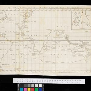
A general chart of the Atlantic and Indian oceans, with the situation & plan of Pulo Peenang or Price of Wales's Island / Plan of the Strait within Poolo Pinang

event1788

location_onMalaysia, East Timor, Indonesia, Papua New Guinea, Singapore

close