Search

Search Results

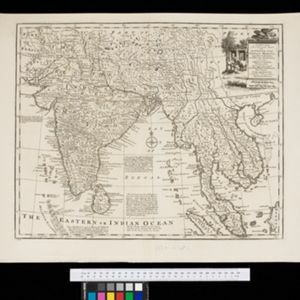
A new and accurate map of the Empire of the Great Mogul, together with India on both sides of the Ganges, and the adjacent countries

eventc.1740

location_onCambodia, Indonesia, Laos, Malaysia, Myanmar, Singapore, Thailand, Vietnam

Notes on this map describe European colonial territories and trade with Asia, though this is concentrated around India, and mostly has not yet reached further east to ‘India extra Gangem [India beyond the Ganges]’ as Southeast Asia is labelled.

India orientalis

event1630

location_onBrunei, Cambodia, Indonesia, Laos, Malaysia, Myanmar, Philippines, Singapore, Southeast Asia, Thailand, Vietnam

Four long rivers flow south through mainland Southeast Asia on this map: the ‘Menan’, ‘Manthabam’ and ‘Cosmin’ originate at a mythical lake (‘Chiamai Lacus’) in southern China, while the ‘Mecon’ (Mekong) flows from the hills of Cochinchina (Vietnam).

Tabvla Asiæ VIII

eventc.1596-1621

location_onMyanmar

Early map by Giovanni Antonio Magini, based on the work of the 2nd century geographer Ptolemy. It is difficult to pinpoint exact locations, but the area labelled ‘India Extra Ganges [India beyond the Ganges]’ could include some of modern Myanmar.

Tabvla Asiae VIII

eventc.1545-1552

location_onMyanmar

Early map by Sebastian Münster, based on the work of 2nd century geographer Ptolemy, featuring strange deformed monsters, including headless men with faces on their torsos, a man with a dog’s head, and a mythical race of cannibals (‘Anthropophagi’).

close

  • Filter from 1545 to 1740

Current results range from 1545 to 1740