Search

Search Results

A language map of Further India and the Indian Archipelago

event1878

location_onBrunei, Cambodia, East Timor, Indonesia, Laos, Malaysia, Myanmar, Philippines, Singapore, Southeast Asia, Thailand, Vietnam

A map of Southeast Asia coloured to indicate the five different language families spoken in the region in the late 19th century. Names of indigenous tribes/languages are marked in red text, with European colonial possessions in grey.

Burmah, Siam and Cochin China

event1875

location_onCambodia, Laos, Malaysia, Myanmar, Thailand, Vietnam

This map of mainland Southeast Asia features short texts noting mines, trade routes and travel times (‘5 to 7 days on Elephants’), history (‘conquered by the King of Siam 1809’), peoples (‘states tributary to the Chinese’) and products (‘Tea Tree’).

Extension of the Electric Telegraph to Canton, Hong Kong, etc. from the Port of Rangoon

event1860

location_onMyanmar, Cambodia, Indonesia, Laos, Malaysia, Singapore, Thailand, Vietnam

Map of a proposed extension of a telegraph system from Rangoon (Yangon, Myanmar) to China. Includes current and projected railways, steam ship routes, and population figures for western China. From the British magazine ‘The Illustrated London News’.

Zoological Geography: Sheet No. 3

event1849

location_onBrunei, Cambodia, East Timor, Indonesia, Laos, Malaysia, Myanmar, Papua New Guinea, Philippines, Singapore, Southeast Asia, Thailand, Vietnam

Two maps showing the distribution of rodent and ruminant animal species, including in Southeast Asia. Lines show the geographical range of individual species, alongside illustrations of the animals featured.

Mountain chains in Asia & Europe

event1849

location_onCambodia, Indonesia, Laos, Malaysia, Myanmar, Philippines, Singapore, Thailand, Vietnam

Mountain chains are represented by black lines; volcanoes by black dots. Three insets maps: expansion of Reguain—island of Taung-ywa, off the coast of Myanmar—due to volcanic activity; geology of Java (with heights of mountains); volcanoes of Luzon.

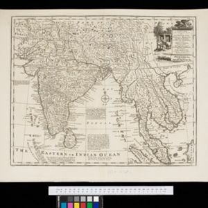
A new and accurate map of the Empire of the Great Mogul, together with India on both sides of the Ganges, and the adjacent countries

eventc.1740

location_onCambodia, Indonesia, Laos, Malaysia, Myanmar, Singapore, Thailand, Vietnam

Notes on this map describe European colonial territories and trade with Asia, though this is concentrated around India, and mostly has not yet reached further east to ‘India extra Gangem [India beyond the Ganges]’ as Southeast Asia is labelled.

To the Right Honourable William, Lord Cowper, Lord High Chancellor of Great Britain, this map of Asia

event1720

location_onBrunei, Cambodia, East Timor, Indonesia, Laos, Malaysia, Myanmar, Papua New Guinea, Philippines, Singapore, Southeast Asia, Thailand, Vietnam

Map dedicated to William Cowper, whose coat of arms sits atop the cartouche. It features two horses holding a crest with three martlets (mythical birds used in heraldry). The cartouche also features Asian traders. Monsoons are marked on the map.

A map of the East-Indies and the adjacent countries: with the settlements, factories and territories, explaning what belongs to England, Spain, France, Holland, Denmark, Portugal &c.

event1720

location_onBrunei, Cambodia, East Timor, Indonesia, Laos, Malaysia, Myanmar, Philippines, Vietnam, Thailand, Southeast Asia, Singapore

This map showcases the colonial territories of Southeast Asia in the 18th century, with text detailing trading information and the products of each region. There are five inset maps featuring plans of specific trading ports.

close

  • Filter from 1720 to 1878

Current results range from 1720 to 1878