Search Results
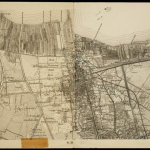
De stad Batavia met derzelver omstreken: Geteekend in 1826
1898
Indonesia
The city of Batavia (Jakarta) with its port and castle is to the north (right side of the map). Koningsplein (Merdeka Square), a large area of rice paddies, graveyards and villages can be seen to the south (left). Copied from a c.1826 map.
Kaart van Padang Si Dimpoewan en omstreken
1895
Indonesia
Map of Padang Si Dimpoewan (modern city of Padangsidempuan, northern Sumatra) including a military camp and accommodation, schools, a market, jail and graveyard. Crops are grown in the surrounding area: rice, coconut, coffee, alang-alang, bamboo.
- Indonesia14
- Singapore11
- Malaysia5
- Philippines4
- East Timor3
- Myanmar3
- Vietnam2
- Brunei1
- Cambodia1
- Laos1
- Papua New Guinea1
- Southeast Asia1
- more Simple Location »
- Dutch East Indies12
- Java11
- Batavia8
- Jakarta8
- Malay Peninsula4
- Sumatra4
- Tanjong Pagar4
- Borneo3
- Fort Canning3
- Java Sea3
- Malacca3
- Malakka3
- more Detailed Location »
- [remove]Cemetery/Columbarium28
- Church27
- Residential Area27
- Hospital22
- Kampong/Village22
- Public Space19
- Court of Law14
- Jail/Prison14
- Military Fort13
- Military Barracks12
- Mosque11
- Police Station11
- Post Office11
- Temple9
- more Settlement Features »
- [remove]Market28
- Shopping Area19
- Factory18
- Warehouse13
- Office11
- [remove]River28
- Road27
- Path16
- Canal12
- Bridge10
- Railway/Tramway10
- Telegraph/Telephone7
- Postal Route5
- Derfelden van Hinderstein, Gijsbert Franco von2
- Akber, Golam1
- Blakelock, D.H.1
- Cronenberg, F.1
- Cronenberg, G.P.F.1
- Dayot1
- Jackson, Lieutenant Philip1
- Jekyll, Captain1
- more Map Maker »
- Stanford's Geographical Establishment3
- Topographische Bureau3
- Homann Heirs2
- Intelligence Branch, War Office2
- C.L. Brinkman1
- D. Heyse1
- De Groot, Kolff en Co.1
- G. Kolff & Co.1
- more Printer/Publisher »
- Batavia3
- London3
- Amsterdam2
- Dehradun1
- Manila1
- New York1
- Nuremberg1
- Nürburg1
- more Place of Publication »