Search

Search Results

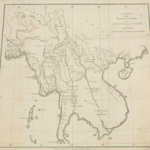
A Sketch of the Birman Empire

eventc.1820

location_onCambodia, Laos, Myanmar, Thailand, Vietnam

This map from 1800 is by the Scottish cartographer Alexander Dalrymple, who was the first Hydrographer of the British Admiralty. It documents the river systems of the Birman Empire (Myanmar) and modern Thailand, Laos, Cambodia and Vietnam.

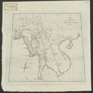
Entwurf des Birmanschen Reichs

event1801

location_onCambodia, Laos, Myanmar, Thailand, Vietnam

Map of the Birman Empire, with hand-drawn internal borders in red. Many of the names of regions, settlements and rivers are labelled with two names, one local and one Western: e.g. ‘Yoodra Shan oder Cambodia’ (‘oder’ is German for ‘or’).

A sketch of the Birman Empire: from a Map of India extra Ganjem

event1800

location_onCambodia, Laos, Myanmar, Thailand, Vietnam

This map from 1800 is by the Scottish cartographer Alexander Dalrymple, who was the first Hydrographer of the British Admiralty. It documents the river systems of the Birman Empire (Myanmar) and modern Thailand, Laos, Cambodia and Vietnam.

close

  • Filter from 1800 to 1820

Current results range from 1800 to 1820