search
search for
search for
search icon
Explore
MapJourneys
Collections
Events
About
Core Team
Search
Search Results
Filter
Map Maker
Groot, J.G. de
close
Remove constraint Map Maker: Groot, J.G. de
Printer/Publisher
Institut National de Géographie
close
Remove constraint Printer/Publisher: Institut National de Géographie
View
Gallery
List
Gallery
Map
Sort
Relevance
Relevance
Date (earliest first)
Date (earliest last)
5 Results found
Filter
filter_list
Kaart van Straat Soenda
event
1883
location_on
Indonesia
Het ingestorte terrein bij Krakatau
event
1883
location_on
Indonesia
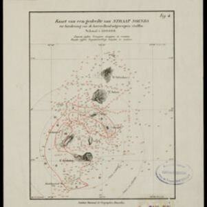
Kaart van een gedeelte van Straat Soenda ter berekening van de hoeveelheid uitgeworpen stoffen
event
1883
location_on
Indonesia
Kaart van het westelijk gedeelte van den Indischen Archipel
event
1883
location_on
Indonesia, Malaysia, Singapore
[Verzamelkaart van door uitbarsting en vloedgolf verwoeste gebieden]
event
1883
location_on
Indonesia
close
Refine your results
Collections
check_box_outline_blank
Leiden University Libraries
5
Date
check_box_outline_blank
1883
5
Language
check_box_outline_blank
Dutch
5
Location
Simple Location
check_box_outline_blank
Indonesia
5
check_box_outline_blank
Malaysia
1
check_box_outline_blank
Singapore
1
Detailed Location
check_box_outline_blank
Krakatoa
5
check_box_outline_blank
Sunda Strait
5
check_box_outline_blank
Dutch East Indies
3
check_box_outline_blank
Java
3
check_box_outline_blank
Sumatra
3
check_box_outline_blank
Eiland Krakatau
2
check_box_outline_blank
Krakatau
2
check_box_outline_blank
Straat Soenda
2
check_box_outline_blank
Calmeyer
1
check_box_outline_blank
Cocos (Keeling) Islands
1
check_box_outline_blank
Eiland Calmeijer
1
check_box_outline_blank
Eiland Seboekoe Ketjiel
1
more
Detailed Location
»
Land Use
Settlement Features
check_box_outline_blank
Kampong/Village
1
Land and Sea Routes
Transport Hubs
check_box_outline_blank
Pier
1
check_box_outline_blank
Port
1
Land Routes
check_box_outline_blank
River
1
check_box_outline_blank
Road
1
Sea Routes
check_box_outline_blank
Bathymetry
3
check_box_outline_blank
Maritime Route
1
Environmental Features
Land Features
check_box_outline_blank
Mountain/Volcano
5
check_box_outline_blank
Wetlands
1
Sea Features
check_box_outline_blank
Reef
3
check_box_outline_blank
Shoal
3
Insets and Attributes
Insets
check_box_outline_blank
Legend
3
Map Attributes
check_box_outline_blank
Scale
5
check_box_outline_blank
Contour Lines/Elevation
2
check_box_outline_blank
Longitude and Latitude
2
Map Production Details
Map Maker
check_box
[remove]
Groot, J.G. de
5
Printer/Publisher
check_box
[remove]
Institut National de Géographie
5
Place of Publication
check_box_outline_blank
Brussels
5