Search

Search Results

India quae Orientalis dicitur, et insvlae adiacentes

event1664

location_onBrunei, Cambodia, East Timor, Indonesia, Laos, Malaysia, Myanmar, Philippines, Singapore, Southeast Asia, Thailand, Vietnam

French text on the reverse of this map describes the religion, languages, crops, trade etc. of Aracam and Pegu (Myanmar), Siam (Thailand), Cambaja (Cambodia). The map is dedicated to the Dutch merchant Christophoro Thisio.

Mar di India

event1659

location_onBrunei, Cambodia, East Timor, Indonesia, Laos, Malaysia, Myanmar, Philippines, Singapore, Southeast Asia, Thailand, Vietnam

This mid-17th century map of the Indian Ocean has a colourful cartouche illustrated with paintings of Asian merchants and warriors with bows and arrows. The scale is decorated with paintings of cherubs.

Insulæ Iavæ cum parte insularum Borneo Sumatræ, et circumjacentium insularum novissima delineatio

eventc.1657-1680

location_onIndonesia

A map of the Java Sea between Java, Sumatra and Borneo. The web of lines is a rhumbline network, used to aid navigation. The cartouche and scale are decorated with paintings of Asian people and mythical creatures including cherubs.

India quae Orientalis dicitur, et insvlae adiacentes

eventc.1645-1658

location_onBrunei, Cambodia, East Timor, Indonesia, Laos, Malaysia, Myanmar, Philippines, Singapore, Southeast Asia, Thailand, Vietnam

German text on the reverse of this map describes the populations, crops, trade etc. of Sumatra, Borneo, Philippines, and Banda Islands. There are drawings of sailing ships, and the map is dedicated to the Dutch merchant Christophoro Thisio.

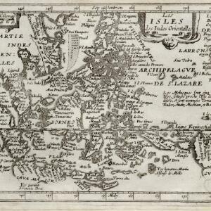
Les isles des Indes orientalles

event1643

location_onBrunei, Cambodia, East Timor, Indonesia, Laos, Malaysia, Myanmar, Philippines, Singapore, Southeast Asia, Thailand, Vietnam

French text on the right of this map notes that the ‘Molucques’—an important region for the spice trade—were near the island of Gilolo (modern Halmahera) and names them as Ternate, Tindor (Tidore), Mutir (Moti), Machiam (Makian) and Bachian (Bacan).

Asia

event1634

location_onBrunei, Cambodia, East Timor, Indonesia, Laos, Malaysia, Myanmar, Philippines, Singapore, Southeast Asia, Thailand, Vietnam

Early Latin map of Asia, with some inaccuracies: only a small part of Java (labelled ‘Iava Major’) is shown, the shape of Celebes (Sulawesi) is much simplified, and New Guinea is enlarged and distorted.

Indiae Orientalis nova descriptio

eventc.1633-1636

location_onBrunei, Cambodia, East Timor, Indonesia, Laos, Malaysia, Myanmar, Philippines, Singapore, Southeast Asia, Thailand, Vietnam

The outline of the island of New Guinea is very vague on this early 17th century map of Southeast Asia. The cartouche is decorated with two figures of Asian warriors: one holds a spear, the other a sword. There are also drawings of mermaids.

close

  • Filter from 1633 to 1664

Current results range from 1633 to 1664