Search

Search Results

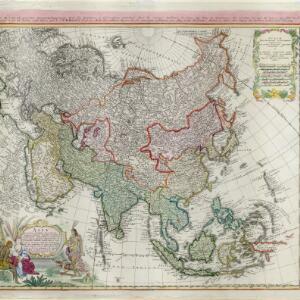
Asia secundum legitimas projectionis stereographicae regulas et juxta recentissimas observation et relationes = Carte de l'Asie, projettée stereographiquement, tirée des relations et observations

event1744

location_onBrunei, Cambodia, East Timor, Indonesia, Laos, Malaysia, Myanmar, Philippines, Singapore, Southeast Asia, Thailand, Vietnam

This mid-18th century map of Asia has a stereographic projection to aid in navigation. There is also an illustration featuring two Asian men depicted as warriors, with a robed woman, as well as a large lizard.

Asia secundum legitimas projectionis stereographicae regulas et juxta recentissimas observation et relationes = Carte de l'Asie, projettée stereographiquement, tirée des relations et observations

event1744

location_onBrunei, Cambodia, East Timor, Indonesia, Laos, Malaysia, Myanmar, Philippines, Singapore, Southeast Asia, Thailand, Vietnam

This mid-18th century map of Asia has a stereographic projection to aid navigation. An illustration features Asian men—probably merchants, one of whom sits on a throne—and a kneeling elephant.

Asia secundum legitimas projectionis stereographicae regulas et juxta recentissimas observation et relationes = Carte de l'Asie, projettée stereographiquement, tirée des relations et observations

event1744

location_onBrunei, Cambodia, East Timor, Indonesia, Laos, Malaysia, Myanmar, Philippines, Singapore, Southeast Asia, Thailand, Vietnam

This mid-18th century map of Asia has a stereographic projection to aid in navigation. There is also an illustration featuring two Asian men depicted as warriors, with a robed woman, as well as a large lizard.

Asia secundum legitimas projectionis stereographicae regulas et juxta recentissimas observation et relationes = Carte de l'Asie, projettée stereographiquement, tirée des relations et observations

event1744

location_onBrunei, Cambodia, East Timor, Indonesia, Laos, Malaysia, Myanmar, Philippines, Singapore, Southeast Asia, Thailand, Vietnam

This mid-18th century map of Asia has a stereographic projection to aid navigation. An illustration features Asian men—probably merchants, one of whom sits on a throne—and a kneeling elephant.

Asia secundum legitimas projectionis stereographicae regulas et juxta recentissimas observation et relationes = Carte de l'Asie, projettée stereographiquement, tirée des relations et observations

event1744

location_onBrunei, Cambodia, East Timor, Indonesia, Laos, Malaysia, Myanmar, Philippines, Singapore, Southeast Asia, Thailand, Vietnam

This mid-18th century map of Asia has a stereographic projection to aid navigation. An illustration features Asian men—probably merchants, one of whom sits on a throne—and a kneeling elephant.

Asia secundum legitimas projectionis stereographicae regulas et juxta recentissimas observation et relationes = Carte de l'Asie, projettée stereographiquement, tirée des relations et observations

event1744

location_onBrunei, Cambodia, East Timor, Indonesia, Laos, Malaysia, Myanmar, Philippines, Singapore, Southeast Asia, Thailand, Vietnam

This mid-18th century map of Asia has a stereographic projection to aid in navigation. There is also an illustration featuring two Asian men depicted as warriors, with a robed woman, as well as a large lizard.

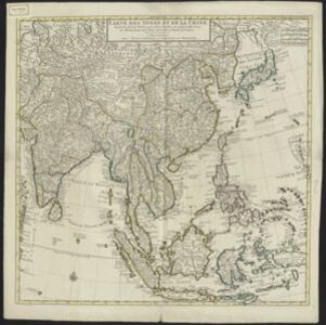
Carte des Indes et de la Chine

eventc.1742

location_onBrunei, Cambodia, East Timor, Indonesia, Laos, Malaysia, Myanmar, Philippines, Singapore, Southeast Asia, Thailand, Vietnam

The regional borders of early 18th century Southeast Asia are shown on this map. Mountains are shown pictorially, and larger settlements are marked with a red building symbol. Southern Borneo is labelled ‘Pays des Mahometans [Land of the Muslims]’.

Nieuwe kaart van de Filippynsche, Ladrones, Moluccos of Specery Eilanden, als mede Celebes etc.

event1740

location_onBrunei, East Timor, Indonesia, Malaysia, Philippines, Vietnam

A label on the island of Borneo states ‘Beajous Afgodendienaars bewonende het middelste gedeelte van 't Eiland [Beajous idolaters inhabit the middle part of the Island]’. Mountains are marked pictorially; settlements with a red building symbol.

Nuove carte delle Isole di Sunda come Borneo, Sumatra e Java Grande &c.

event1740

location_onBrunei, Cambodia, Indonesia, Malaysia, Singapore, Thailand

Based on a Dutch map of the Sunda Islands, with the text changed to Italian. Some Dutch remains e.g. a label on Borneo: ‘Beajous Afgoden dienars bewonende het middelste gedeelte vant Eilland [Beajous idolaters inhabit the middle part of the Island]’.

close