Search

Search Results

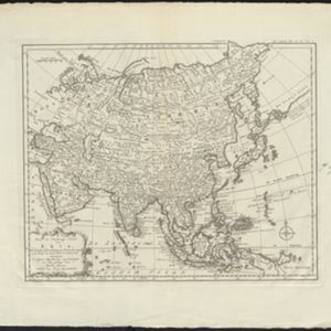
Nieuwe en naukeurige kaart van Asia

event1773

location_onIndonesia, Brunei, Cambodia, East Timor, Laos, Malaysia, Myanmar, Papua New Guinea, Philippines, Singapore, Southeast Asia, Thailand, Vietnam

Map of Asia featuring an early—and very vague—depiction of New Britain (‘Nieuw Brittanje’) which was named by the British explorer William Dampier when he visited in 1700. The ‘Straat van Dampier’ is also shown, dividing New Britain from New Guinea.

L'Asie Divisée en ses Grandes Régions et Empires: Subdivisée en ses Principaux Estats

event1759

location_onBrunei, Cambodia, East Timor, Indonesia, Laos, Malaysia, Myanmar, Philippines, Singapore, Southeast Asia, Thailand, Vietnam

Map of the regions, empires and states of Asia. Extensive notes cover religion (people of mainland Southeast Asia are idolaters), colonialism (Dutch and Portuguese rule in Malacca and the Sunda Islands) and the spice trade of the Maluku Islands.

Nuova carta dell' India di là del Fiume Ganges overo di Malacca, Siam, Cambodia, Chiampa, Kochinchina, Laos, Pegu, Ava &c.

event1740

location_onBrunei, Cambodia, Indonesia, Laos, Malaysia, Myanmar, Singapore, Thailand, Vietnam, Southeast Asia

Based on a map by Guillaume Delisle, this map of Southeast Asia shows mountains and settlements pictorially, with larger cities also coloured red. Regional borders are colour-coded, as are some internal borders on the Malay Peninsula.

Insvlæ Indicæ cvm terris circvmvicinis

eventc.1702-1710

location_onVietnam, Myanmar, Papua New Guinea, Philippines, Singapore, Southeast Asia, Thailand, Malaysia, Laos, Indonesia, East Timor, Cambodia, Brunei

The cartouche on this colourful early 18th century map of Southeast Asia is decorated with a wreath, pearls, textiles and an exotic bird. The scale is in German, Spanish, French, Italian and English miles.

close