Search

Search Results

Grundris der stadt und citadelle Batavia

event1785

location_onIndonesia

A plan of the port of Batavia with a detailed legend identifying parts of the city. The sword and laurel wreath of the city’s coat of arms, and the Dutch East India Company flag (marked ‘VOC’ or ‘Vereenigde Oost Indische Compagnie’) are also shown.

Carte des environs de Batavia = Kaart van de buitenstreeken van Batavia

eventc.1772-1780

location_onIndonesia

This late 18th century map of Batavia (Jakarta) focusses on the network of canals and rivers surrounding the city, as well as the many fields and plantations, including rice fields (‘Champ de Ris’) and sugarcane (‘Cannes de Sucre’).

Particular-see-charte der Strass Sunda, nebst denen darinnen befindlichen insulen und sandbäncken

event1744

location_onIndonesia

A navigation map of part of the north coast of Java, featuring the ports of Batavia (Jakarta) and Bantam (Serang). Includes colourful paintings of a ‘menschen fressers [cannibal]’ island, Javanese people and palm trees (dates, banana, coconut).

A new and correct chart of part of the island of Java from the west end to Batavia with the Streights of Sunda

event1711

location_onIndonesia

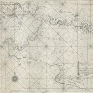
This early 18th century maritime map charts the waters of the Straits of Sunda, between the islands of Java and Sumatra. The web of lines is a rhumbline network, while the numbers indicate sea depth (bathymetry), both used to aid navigation.

Les isles Philippines et celles des Larrons ou de Marianes, les isles Moluques et de la Sonde, avec la presqu'isle de l'Inde de la le Gange ou orientale

event1706

location_onBrunei, Cambodia, East Timor, Indonesia, Laos, Malaysia, Myanmar, Philippines, Singapore, Southeast Asia, Thailand, Vietnam

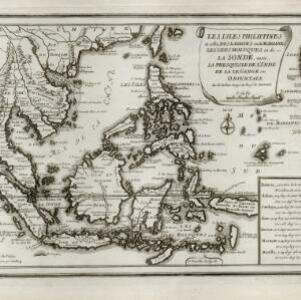
This early 18th century map of Southeast Asia includes a list detailing the location (latitude and longitude) of seven important cities in the region: Batavia, Achem, Camboya, Siam, Borneo, Macaçar and Manilla.

A mapp of Batavia with all itts forts

event1704

location_onIndonesia

This early 18th century map of Batavia (Jakarta) shows an important port city, with military forts, a long pier, and many ships at sea. However, the map also shows a city surrounded by fields and plantations, for producing crops and grazing animals.

A mapp of the islands before Batavia

event1704

location_onIndonesia

This early 19th century map is from a book titled ‘Mr. John Nieuhoff's Voyages’ in which the author reports on his travels to Southeast Asia, including a detailed description of the important port city of Batavia, as shown on the map.

Citadelle de Batavia

event1683

location_onIndonesia

These two paintings show the port of Batavia (Jakarta) from the sea. The upper image focusses on the castle, while the lower image depicts a sea battle—possibly a 1618 battle between the British and Dutch—with the city in the background.

Ware affbeeldinge wegens het casteel ende stadt Batavia gelegen opt groot eylant Java anno 1669

event1670

location_onIndonesia

A plan of the important port of Batavia (Jakarta), with the fort, river, city streets and fields. Decorative illustrations include ships in the harbour, a view of the city and mountains, and the city’s coat of arms: a lion holding a sword and shield.

close

  • Filter from 1670 to 1785

Current results range from 1670 to 1785