Search

Search Results

Asia and its islands according to D'Anville

event1799

location_onBrunei, Cambodia, East Timor, Indonesia, Laos, Malaysia, Myanmar, Papua New Guinea, Philippines, Singapore, Southeast Asia, Thailand, Vietnam

This late 18th century map features a number of labels describing the local populations, including the Kemoys ('Savage People') of the mountains of Cokin China (Vietnam), the Biayos of Borneo, and the 'Wild People' of the mountains of Pegu (Myanmar).

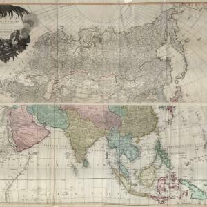
Asia and its islands according to D'Anville: divided into empires, kingdoms, states, regions, &ca.

event1794

location_onBrunei, Cambodia, Indonesia, East Timor, Laos, Malaysia, Myanmar, Papua New Guinea, Philippines, Singapore, Thailand, Vietnam, Southeast Asia

This late 18th century map features a number of labels describing the local populations, including the Kemoys ('Savage People') of the mountains of Cokin China (Vietnam), the Biayos of Borneo, and the 'Wild People' of the mountains of Pegu (Myanmar).

A new chart of the Oriental Seas and Islands... from the Isle of Ceylon to Amoye in China

event1790

location_onBrunei, Cambodia, East Timor, Indonesia, Laos, Malaysia, Myanmar, Philippines, Singapore, Southeast Asia, Thailand, Vietnam

A late 18th century maritime map of Southeast Asia, marked with expedition routes including the return of Captain Cook’s HMS Endeavour from Australia in 1770, and Captain Philip Carteret’s circumnavigation expedition in 1768.

Present Asia

event1783

location_onVietnam, Myanmar, Philippines, Singapore, Southeast Asia, Thailand, Malaysia, Laos, Indonesia, East Timor, Cambodia, Brunei

Coloured borders divide this late 18th century map of Asia into empires, kingdoms and regions. Five major rivers that flow south through mainland Southeast Asia are named: Aua, Pegu, Tenasserim, Menan and Camboya.

An Accurate map of India beyond the Ganges with the oriental islands, generally called East India

event1780

location_onBrunei, Cambodia, East Timor, Indonesia, Laos, Malaysia, Myanmar, Philippines, Singapore, Southeast Asia, Thailand, Vietnam

This map uses colour to identify regions in late 18th century Southeast Asia, many of which roughly correspond to modern countries: Pegu=Myanmar, Tonkin/Cochin China=Vietnam, Lao =Laos, Siam=Thailand, Malaya=Malaysia, Philippin Islands=Philippines.

A new mapp of y Empire of China: with its severall provinces or kingdomes, together with the adjacent isles of Japan or Niphon, Formosa, Hainan etc.

event1669

location_onCambodia, Laos, Philippines, Thailand, Vietnam, Myanmar

Although mainly of China and Japan, this map includes some of the northern parts of Southeast Asia. The map is dedicated to Sir Thomas Peyton, an English Member of Parliament who was imprisoned for supporting the king during the English Civil War.

close