Search

Search Results

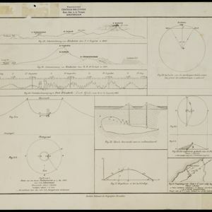
[Grafieken en tekeningen betreffende de uitbarsting van de Krakatau in 1883]

event1883

location_onIndonesia

A series of graphs and drawings about the 1883 eruption of the Krakatoa volcano. Includes elevation views from 1849 and 1880, a globe showing where the eruption was heard, a sketch of the crater of one of the cones, and a cross-section of a volcano.

Kaart der Residentie Bantam

event1854

location_onIndonesia

Map of the Dutch colonial administrative region (residency) of Bantam (Banten, Java) divided into four regencies, featuring Banten Bay and Krakatoa. (From ‘Algemeene Atlas van Nederlandsche Indie [General Atlas of the Dutch East Indies]’.)

close

  • Filter from 1854 to 1883

Current results range from 1854 to 1883