Search

Search Results

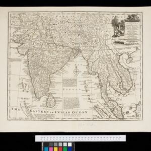
A new and accurate map of the Empire of the Great Mogul, together with India on both sides of the Ganges, and the adjacent countries

eventc.1740

location_onCambodia, Indonesia, Laos, Malaysia, Myanmar, Singapore, Thailand, Vietnam

Notes on this map describe European colonial territories and trade with Asia, though this is concentrated around India, and mostly has not yet reached further east to ‘India extra Gangem [India beyond the Ganges]’ as Southeast Asia is labelled.

Asiæ pars Avstralis. Insulæ indicae cvm svis naturæ dotibvs

eventc.1702-1710

location_onBrunei, Cambodia, East Timor, Indonesia, Laos, Malaysia, Myanmar, Papua New Guinea, Philippines, Singapore, Southeast Asia, Thailand, Vietnam

This early 17th century map of Southeast Asia is beautifully decorated with images of wild animals, including camels, a rhinoceros and various birds and fish. There is also a large decorative compass rose.

close

  • Filter from 1702 to 1740

Current results range from 1702 to 1740