Search Results

Westkust Celebes: Vaarwaters benoorden Makasser: Blad II
1898
Indonesia
Navigation map of the west coast of Celebes (Sulawesi), north of Makassar. Bathymetry (sea depth), shoals and other obstructions are marked, with hills and settlements as landmarks, and elevations (side views of hills) to aid navigation.

Westkust Celebes: Vaarwaters benoorden Makasser: Blad I
1898
Indonesia
Navigation map of the west coast of Celebes (Sulawesi), north of Makassar. Bathymetry (sea depth), lighthouses, shoals and other obstructions are marked, with trees and hills as landmarks, and elevations (side views of hills) to aid navigation.

Westkust Celebes: Vaarwaters benoorden Makasser: Blad III
1898
Indonesia
Navigation map of the west coast of Celebes (Sulawesi), north of Makassar. Bathymetry (sea depth), shoals and other obstructions are marked, with hills and settlements as landmarks, and elevations (side views of hills) to aid navigation.

Kaart van een Gedeelte der Kust van Cochin-China, met de baai en haven van Turon, en het eiland Kal Lao
1793
Vietnam
A map to aid navigation around the Bay of Turon (location of modern city of Da Nang, Vietnam). Bathymetry (sea depth) is marked, as is the route of the Dutch ship ‘Jackaij’ on her departure from the bay. An elevation view of the land is shown below.

L'Asie dressée sur les observations de Mrs. de l'Academie Royale de Sciences
1730
Brunei, Cambodia, East Timor, Indonesia, Laos, Malaysia, Myanmar, Philippines, Singapore, Southeast Asia, Thailand, Vietnam
This map features maritime routes: between Siam and Batavia; and five routes of the explorers Juan Gaetan and Olivier du Nord (dated 1542) east of the Philippines. The cartouche has a colourful illustration of Asian people in traditional costume.

Deese wassende pas-kaart van Oost-Indien, is nu te bekoomen voor die deselve begeeren
c.1728-1738
Brunei, Cambodia, East Timor, Indonesia, Laos, Malaysia, Myanmar, Papua New Guinea, Philippines, Singapore, Southeast Asia, Thailand, Vietnam
Map of the Indian Ocean dominated by a rhumbline network—a web of interconnected lines used to help plot routes—with a compass rose at the centre. At the top there are (incomplete) drawings of people with text in Dutch, French, English and Spanish.

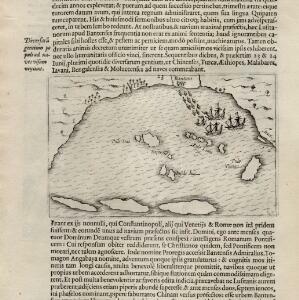
[View of the Bay of Bantam with Houtman's ships]
1614
Indonesia
Two pages from ‘Rerum et urbis Amstelodamensium historia’ by Johannes Pontanus, featuring a drawing of the Dutch merchant seaman Cornelis de Houtman’s ships anchored in the Bay of Bantam (Banten, Java) during the first Dutch expedition to the region.


