Search

Search Results

Insula Borneo et occidentalis pars Celebis cum adjacentibus insulis

event1657

location_onIndonesia

The orientation of this map is unusual, with north to the right, so the west coast of Borneo is at the top. Its cartouche is decorated with drawings of seafaring people, and the scale with cherubs playing with cartography tools such as callipers.

Insulæ Iavæ cum parte insularum Borneo Sumatræ, et circumjacentium insularum novissima delineatio

eventc.1657-1680

location_onIndonesia

A map of the Java Sea between Java, Sumatra and Borneo. The web of lines is a rhumbline network, used to aid navigation. The cartouche and scale are decorated with paintings of Asian people and mythical creatures including cherubs.

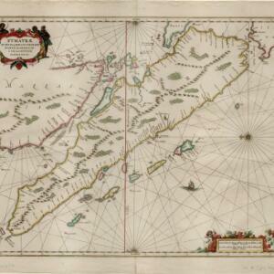
Svmatrae et insularum locorumque nonnullorum circumiacentium tabula noua

eventc.1657-1680

location_onIndonesia, Malaysia, Singapore

Mountains and jungles are shown pictorially on this map of Sumatra and surrounding islands. The cartouche is decorated with Asian warriors; the scale with cherubs playing with cartography tools. From Jan Jansson’s Latin edition of ‘Atlas Maritimus’.