Search

Search Results

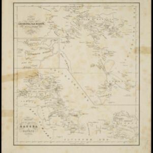
Kaart van de westerhelft der residentie Rembang

event1858

location_onIndonesia

Topographic map of the residency of Rembang, Central Java, divided into regencies and districts. Roads and villages are marked, with shoals, reefs and water depth at sea. An inset map of the city of Rembang features markets, warehouses, churches.

Asiatic archipelago

event1858

location_onVietnam, Myanmar, Papua New Guinea, Philippines, Singapore, Southeast Asia, Thailand, Malaysia, Laos, Indonesia, East Timor, Cambodia, Brunei

This late 19th century map of Southeast Asia shows the best maritime routes around the region, according to the time of year. There are also inset maps highlighting the rivers and southern islands of Singapore, and the sea depth around Labuan Island.

Kaart van den archipel van Riouw, Singapore en Lingga / Kaart van de eilanden Bangka en Blitong

event1857

location_onIndonesia, Singapore

Two maps featuring many of the islands between the Malay Peninsula, Sumatra and Borneo. In the top map, Batam, Bintan, Lingga and many of the smaller Riau Islands. In the bottom map, Bangka and Belitung on the east coast of Sumatra.

Ost-Indien mit den Inseln

event1857

location_onCambodia, Brunei, East Timor, Indonesia, Laos, Malaysia, Myanmar, Philippines, Singapore, Southeast Asia, Thailand, Vietnam

On this map of India and Southeast Asia, borders are outlined and cities underlined in different colours to show the colonial territories of the European powers. Independent states such as Birma, Siam and Annam are also marked.

Kaart van het Eiland Soembawa

event1856

location_onIndonesia, East Timor

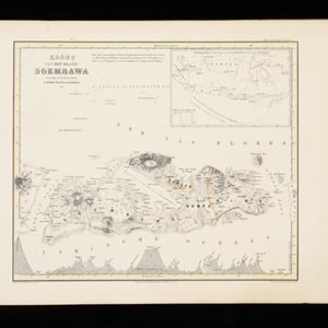
Map of the island of Soembawa (Sumbawa) featuring an inset map of the 1815 eruption of Mount Tambora, and an elevation showing heights of mountains. (From ‘Algemeene Atlas van Nederlandsche Indie [General Atlas of the Dutch East Indies]’.)

Nederlandsche overzeesche bezittingen / Oost-Indië

event1856

location_onBrunei, East Timor, Indonesia, Malaysia, Singapore

Map of the East Indies, showing Dutch colonial territory (Dutch East Indies) in the mid-19th century. Coloured borders are used to highlight internal administrative regions. Three inset maps show other Dutch territories outside Southeast Asia.

Kaart van een gedeelte der Westkust van Sumatra

event1855

location_onIndonesia

Hachures—short lines/dashes that give a sense of the shape and steepness of terrain—are used to show the mountains of Sumatra’s west coast, and of the Padang Highlands and Lowlands. Text lists the heights of some of the region’s chief mountains.

Kaart van het eiland Java

event1855

location_onIndonesia

Detailed map of Java based on the expeditions of the geologist and botanist Dr. Franz Junghuhn. There are 16 inset maps featuring volcanoes, mountains and coal seams.

Kaart van het eiland Java

event1855

location_onIndonesia

Detailed map of Java based on the expeditions of the geologist and botanist Dr. Franz Junghuhn. There are 16 inset maps featuring volcanoes, mountains and coal seams.

East Indies

event1855

location_onBrunei, Cambodia, East Timor, Indonesia, Laos, Malaysia, Myanmar, Philippines, Singapore, Southeast Asia, Thailand, Vietnam

Coloured borders are used to highlight the colonial territories of the British (red), Dutch (orange), Spanish (red) and Portuguese (blue) on this mid-19th century map of Southeast Asia. An inset map shows the island and strait of Singapore.

close